Original version in Dutch: Dagenlang geen signaal. Alleen de dolfijnen geven antwoord – NRC
Category Archives: Cruises
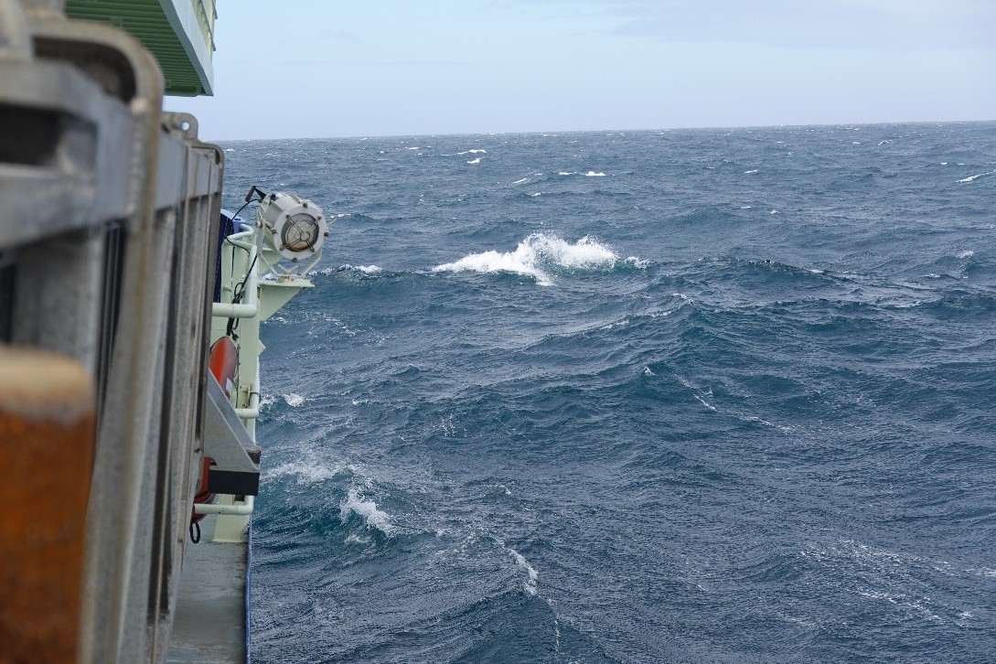
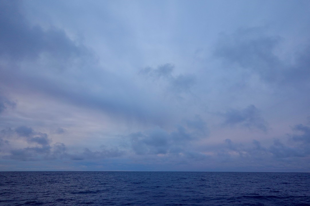
RRS Discovery – DY182: Icelandic basin and Irminger Sea
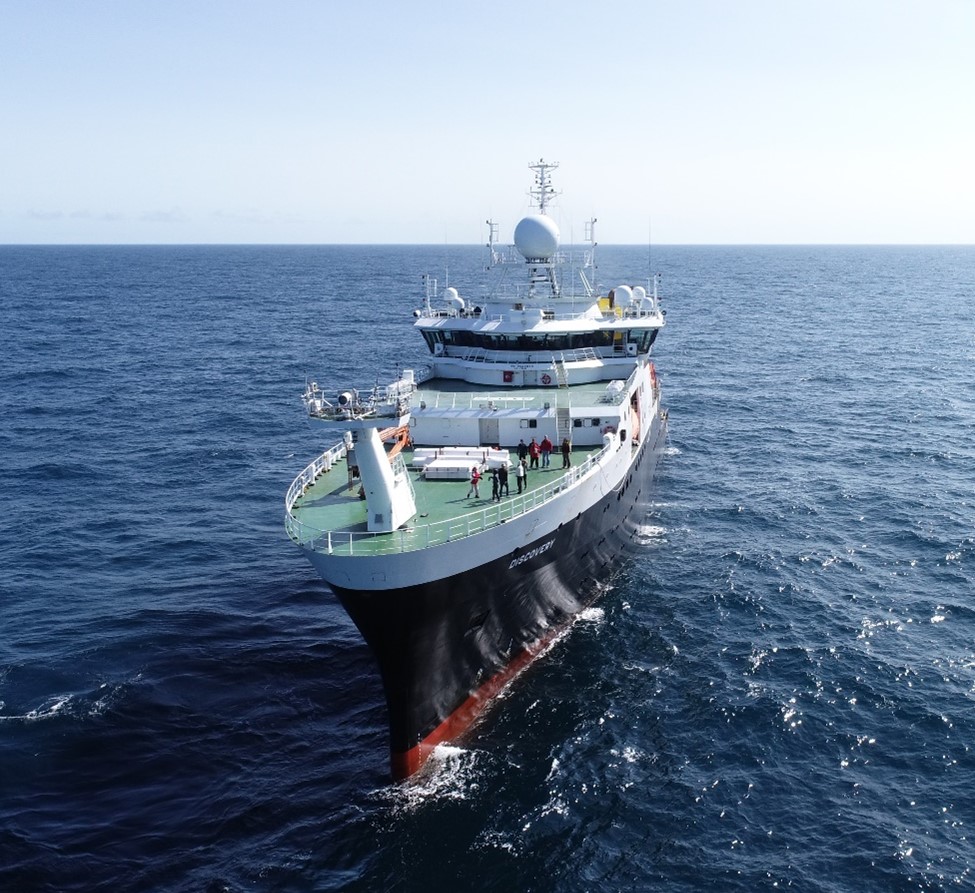
The RRS Discovery on a rare sunny day in the Irminger Sea, taken by the U. Miami drone.
Femke den Ouden – Student Utrecht University
When I got an email from my Marine Sciences Master (Utrecht University) coordinator that you could sign up to join the DY182 cruise on the RRS Discovery, I didn’t hesitate. My main scientific interest is physical oceanography and the cryosphere and I just finished a course in which we elaborately discussed the AMOC and the OSNAP project. How amazing is it to actually experience a project and region like this, instead of only seeing it on a lecture screen?! When I heard that I would also be able to write my master thesis with NIOZ on the OSNAP data, I was even more excited to be able to experience the data collection hands on. I bought all the clothing needed for the expected cold and wind in the North Atlantic, did my safety training and medical exam and flew, together with my fellow students, to Reykjavik to start this adventure!
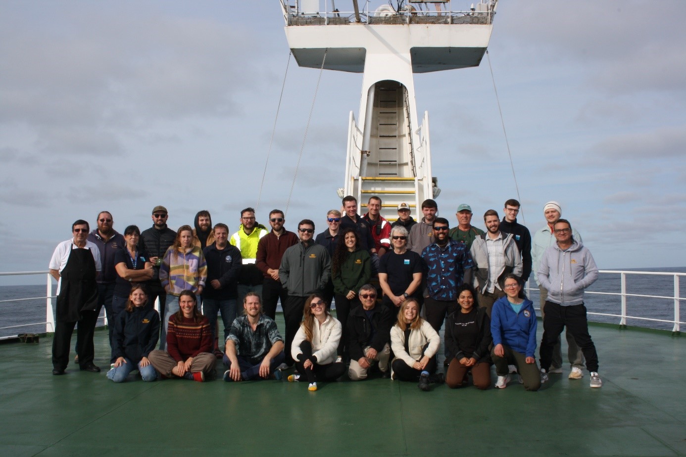
Group photo!
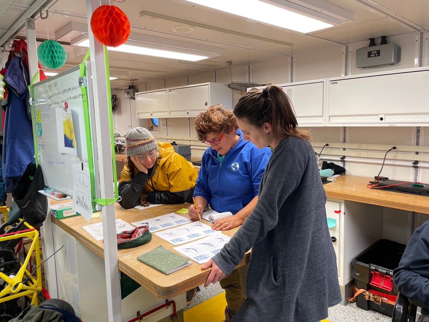
The DY182 cruise is shared between the University of Miami (moorings in the Icelandic basin, east of the Mid-Atlantic Ridge) and NIOZ (moorings in the Irminger sea, west of the Mid-Atlantic ridge). The University of Miami team is full of experienced seafarers: Tiago, chief scientist for the first time (lobbyist for a Brazilian barbeque on deck); Bill, the most experienced oceanographer and one of the founders of OSNAP (and the best cribbage teacher); and oceanographers and technicians Eduardo (who looks like a superhero in his safety harness), Cedric (likes to drink an IPA each night), Joe (No need for a spare anchor this time) and Houraa (showing exponential growth in her darts skills). From the Netherlands (NIOZ and Utrecht University) we came with a relatively inexperienced team. However, I feel like we bring a lot of enthusiasm and energy to the ship. Sasha, PhD student and the only one with real seagoing experience (can finally use his bike helmet); Emma, working on her virtual ship classroom (voluntarily wakes up at 4 in the morning); Claudia, having a do-over for the 2022 cruise (has a hate relationship with Microcats and a love relationship with Iceland); Laura, journalist of NRC writing an article on the AMOC (whose favourite moment of the day is sitting at the back deck with a book and cup of tea); Dave, NIOZ technician who impressed the whole ship with his efficient recoveries and deployments (can be found in the gym each day); and then lastly the students Aart (programming specialist and foosball star player) Ann (LOVES cleaning buoys with slimy marine life), Josefien (always does a happy dance when walking along the amazing food buffet), and me, Femke (the sports instructor of our team). And of course, the amazing technicians Ellis, Dean, Dave, John and Tom, and the rest of the crew!
Besides the fact that the whales have been exceptionally absent this cruise, it has been amazing so far! We have had some very sunny days during which we could chill at the front or back deck, some great sunsets and sunrises, and not many fogs for which the Irminger sea is famous. I am very aware that I got very spoiled to have the Discovery as the ship for my first cruise. The ship is super stable so it took me only 2 days to grow my sea legs. Furthermore, we have the extreme luxury of CTD operators from the ship, which means that they do most of the CTD work. This gives us more time to learn about the moorings and their data. The food here is amazing, Peter, Neil, Tina and Tony make sure that all our hearts and stomachs desires are met. Luckily there is a relatively large sports gym, otherwise I would gain a kilo per week due to their amazing cooking and hospitality. The whole crew is amazing, they have made me feel welcome since day 1 and the Discovery has really started to feel like home in these past weeks.
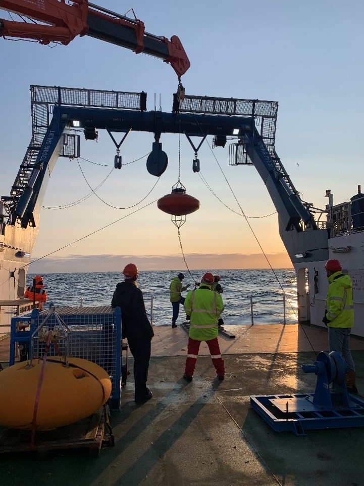
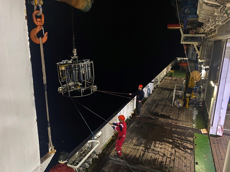
Early morning deployment of a NIOZ mooring.
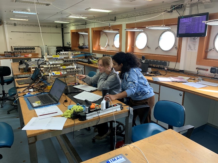
Femke and Ann programming and reading out instruments of the moorings.
Josefien’s typical day at the RRS Discovery
7:15 Waking up
My alarm goes off. The science cabins for the students are located on the Main Deck, which is on the same level as the sea, so I wake up with the sounds of waves splashing against my two small round windows.
7:30 Breakfast
The galley (the ship’s kitchen) is two floors up. Here, you find your typical English breakfast made by Peter and Neil. At 8:00 the first monitor check needs to be done, which only takes a couple minutes and needs to be done every two hours.
8:30 Science meeting
After breakfast we go one floor down to head towards the Main Lab. We meet up with the scientists, students, technicians and captain to discuss today’s research plan based on the weather forecast.
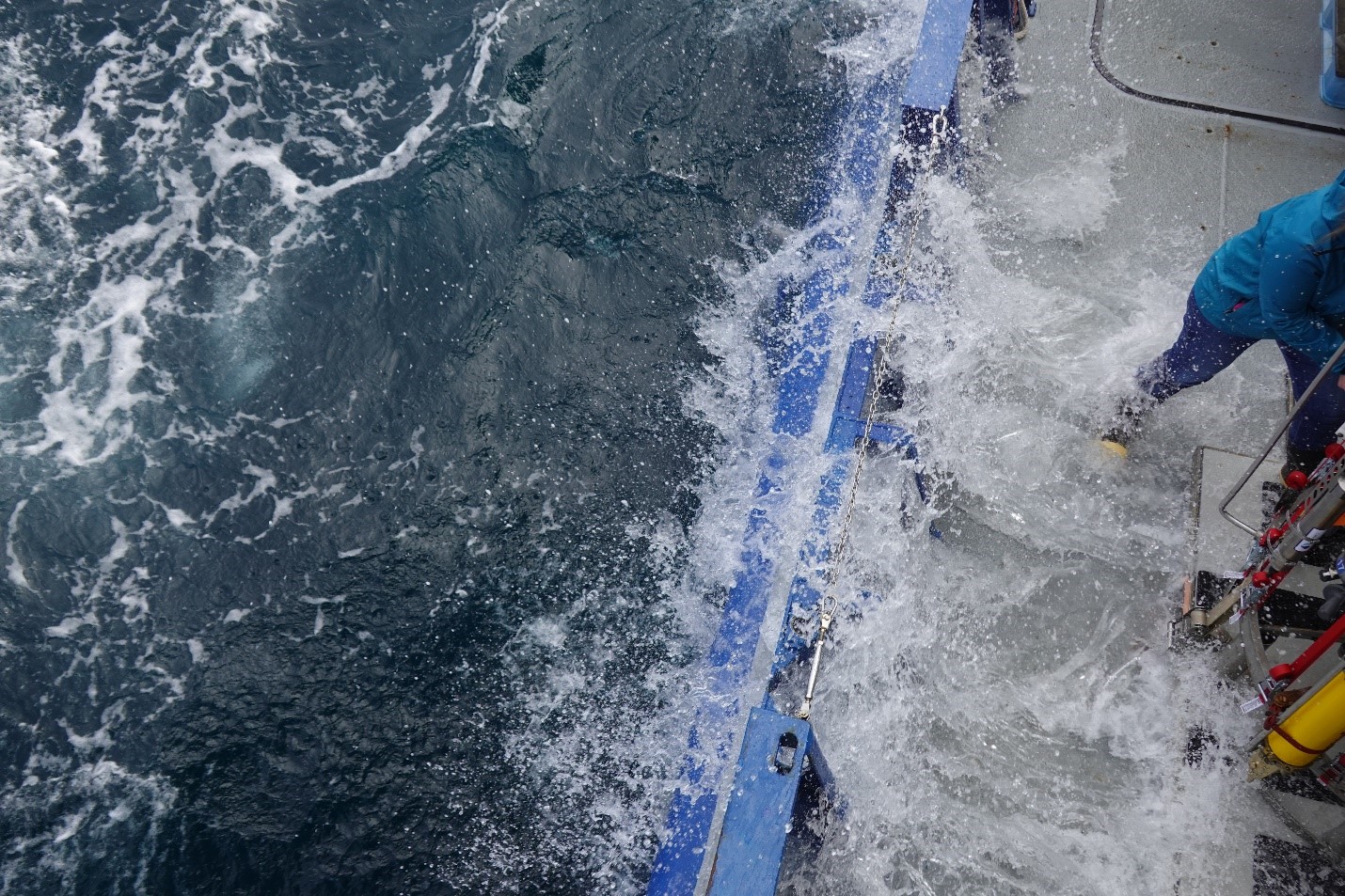
9:00 Mooring recovery
After spotting the big yellow buoys in the sea, the mooring is attached to the ship and cautiously lifted out of the water. Dave, our technician, carefully detaches each instrument; this takes a pretty long time since the mooring can be up to 2500 m. We help with cleaning the instruments (after two years in the ocean the devices are covered in algae and some slimy worms) and bring them inside to stop the logging and start reading out the data. In the rush of the mooring recovery, I forgot the monitor checks at 10:00, oops…
11:30 Lunch.
A nice and warm lunch is prepared for everybody. Way better than the slices of bread I would eat in the Netherlands! With so many options, your plate could look completely different from your neighbour’s.
13:30 CTD
CTD time! The CTD Rosette collects water samples at different depths and measures the salinity, temperature and pressure on its way. We log the timing and coordinate position. Meanwhile, we begin programming the Microcats – devices that measure salinity, temperature, and conductivity – for a ‘Caldip.’ This calibration process compares the CTD measurements with those from the Microcats to determine their placement on the mooring line for deployment. Once the CTD is back on deck, we collect water samples and the technicians analyse them in the Salinity Lab.
15:30 Plankton
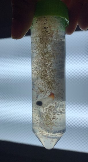
We deploy a plankton net to a depth of 50 meters. After the cruise, DNA analysis will be conducted on the collected plankton. To prevent contamination with human DNA, we handle the plankton net only with plastic gloves. In addition to lot of plankton, the catch also included fish larvae and miniature sea snails.
16:00 Sports
Together with Femke, Emma, Laura and technician Ellis, I am doing an intense workout in The Hold below the deck. Exercising is a lot harder on a moving ship, but way more fun!
17:30 Dinner and spare time
With the whole crew we have a nice dinner, especially the desserts are amazing. After dinner, we hang out in the bar, have a beer (max two per day is allowed), and play some games. Especially foosball and darts are popular. Unfortunately, Aart is on the winning hand with foosball… After watching an episode of Game of Thrones with some people, I go to my cabin to sleep.
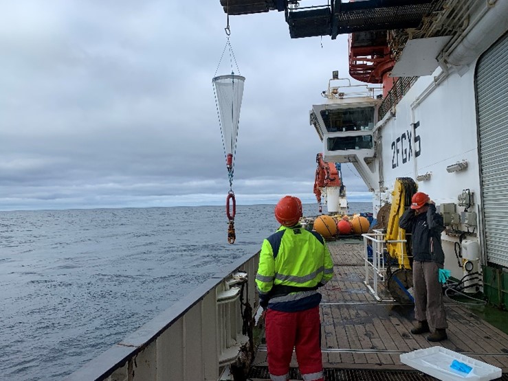
Daily plankton sampling.
Laura Bergshoef – Journalist NRC
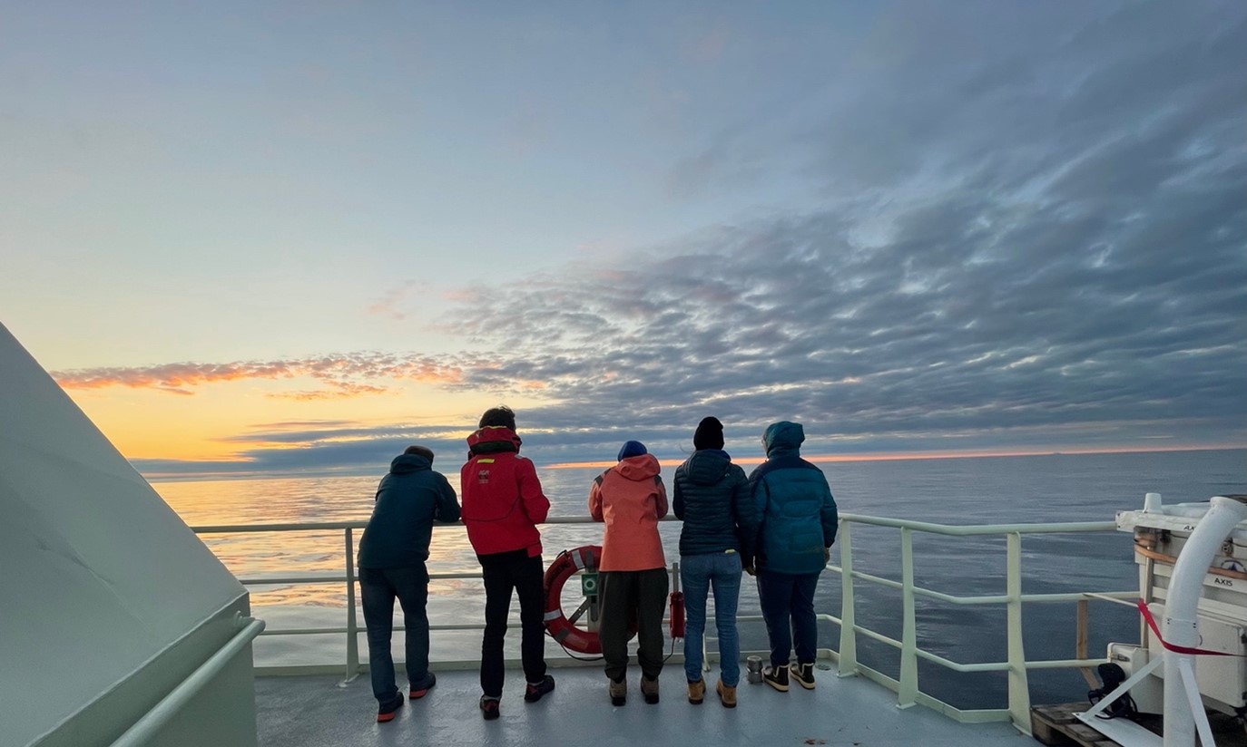
A day on the ship is never boring. Around us it might seem as an endless emptiness: just ocean, clouds and I only saw one other ship during the cruise. But inside the ship it’s never silent. Constantly you will hear ventilators, men with helmets talking though radio’s, rolling bottles and stories about pirates. I have been wandering around the ship a lot during day and night (and even saw the northern lights). Before coming on board I expected that life on sea will be lonely as we are so remotely. But the opposite is true. On the RRS Discovery – crossing the North Atlantic – we all eat, sport, watch Olympics, play games together as one big family on a Christmas holiday.
Surprisingly for me was that at night, the ship is controlled in complete darkness. Looking outside from the bridge, it felt like driving a car at night without any light.
As a journalist I always try to get as close to my topic as possible. When Femke de Jong and I arranged a time and date for our newspaper interview and she joked that if I wanted to come as close to her work as possible I should join this cruise on the North Atlantic, I thought ‘why not’. As a climate scientist/oceanographer by training and author joining a cruise like this for a story is a dream come true. I think it’s one of the most special stories I will ever write.
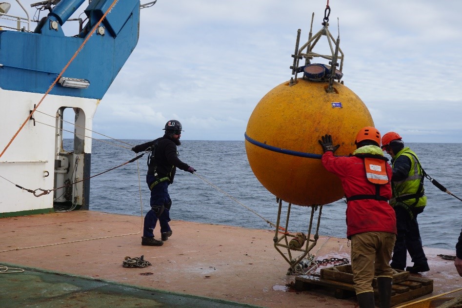
Recovery of the American moorings.
Nightly CTD stations
Posted in blog, Cruises, News, Student/Postdoc Blog
RRS Discovery – DY181, Aberdeen (UK) to Reykjavik (Iceland)
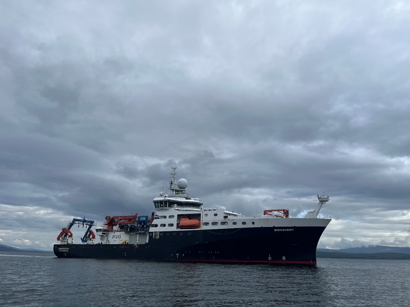
RRS Discovery before navigating the Sound of Mull, Westcoast Scottland.
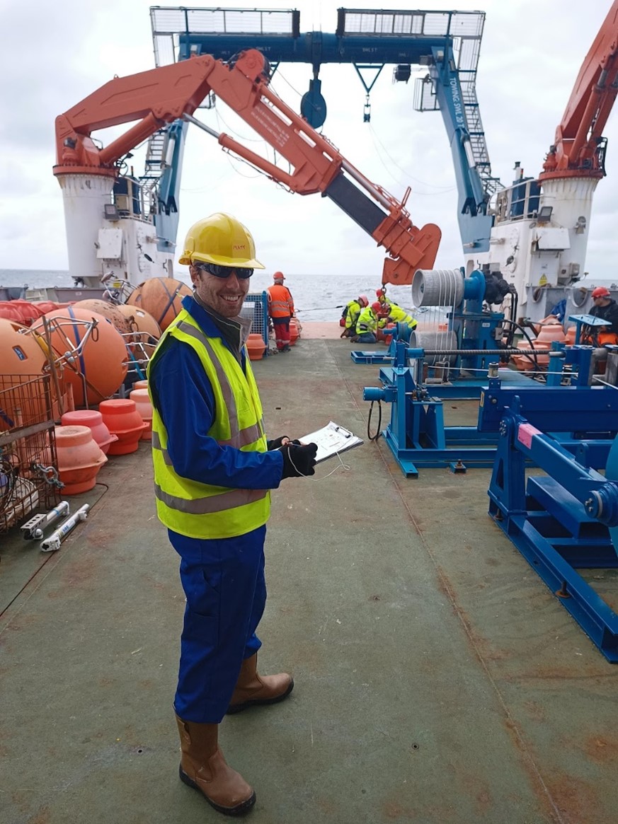
The easternmost moorings of the OSNAP line are maintained by the UK project partners NOC (National Oceanography Center) and SAMS (Scottish Association for Marine Science) under the project AtlantiS. 2024 is a special anniversary year, as it will complete 10 years of OSNAP raw data. For me it is very special, as it is the first time I am leading a cruise. The UK cruise DY181 on RRS Discovery started in Aberdeen, UK on 3 July and we plan to arrive in Reykjavik, Iceland on the 28 July. As part of AtlantiS, we offered berths of opportunity on our OSNAP cruises to give early career scientists the chance to gather cruise experience or take part in the cruises with their own projects. In the following weeks, the successful candidates of the programme will introduce themselves here on the blog and share their cruise experience with you. For day-to-day updates we will post regularly under #DY181 on X. I hope you will enjoy the blog!
Kristin (SAMS, UK)
Me on deck monitoring the deployment of one of our moorings
Hello there, I’m Matt! I’m a physical oceanography research scientist from the National Oceanography Centre (NOC), Southampton. On board DY181, I am one of the physics watch leads. There are 3 physics watches, but what does this mean? We have 3 teams of physical oceanographers, meaning we can maintain operations 24 hours a day. I lead the 08:00 – 16:00 watch, but there is also a 16:00 – 00:00 followed by a 00:00 – 08:00.
What do we do? Every 4 hours, we do ‘the rounds’, which involves checking all the underway (permanently running) systems we use and make sure they are operating and logging correctly. At this time, we also take a surface seawater sample. We continually pump seawater into one of our labs and pass it through temperature and salinity sensors. Taking samples allows us to do checks to see if these sensors are operating correctly, within expected ranges.
The physics watch also oversee the deployment and recovery of our CTD rosette (conductivity-temperature-depth profiler). Our wonderful technicians who operate and maintain this piece of equipment trigger Niskin sampling bottles to close at depths that the chemistry and biology teams want to sample at. After the technicians hand over the data files from the CTD, the physics watch then process the data. While we do have some code that automates most of the process, we do have to manually tag any measurements that look like electrical noise.
We also help out the moorings team by assisting with logging instrument serial numbers that are used on the moorings. Or occasionally help with carrying or cleaning the instruments.
As you can see, life on board is very varied and there’s lots to keep us busy!
Dr Matt Clark
I am Anneke, a first-year PhD candidate at NOC Southampton. At NOC, I’m in the Marine Physics and Ocean Climate (MPOC) Department. In my research, I am using satellite altimetry in combination with in-situ measurements of temperature and salinity to obtain a basin-wide estimate of volume transport of the Atlantic Meridional Overturning Circulation (AMOC) and assess how that transport might change with latitude and how those changes might impact the regional climate.
On DY181, I am part of the Physics watch. My main tasks are taking salinity samples from the CTD-casts as well as the underway sampling system and doing some initial processing of the CTD data. Interestingly (Or lazily😉), we don’t analyse the salinity samples ourselves. This is almost exclusively done by the technicians on-board. Maybe because the salinometer can be a little temperamental…
I am also the designated Marine Mammal Observer (MMO). MMOs make sure that the acoustic systems we carry on board to measure depth and plot bathymetric profiles (single-mean and multi-beam echosounders) don’t pose a risk to marine mammals, specifically the organs that allow them to do echolocation. Usually, this is not a problem as we operate the echosounders on a continuous basis so there is no sudden exposure to sound for any mammals in the vicinity. During certain science operations, however, the acoustic signals from the echosounders can interfere. This is the case during the release of moorings when recovering, or when determining the position of a mooring after deployment (ranging and trilateration), for example. In those cases, the echosounders have to be switched off and my job is to make sure they are not switched off for too long, to avoid this sudden exposure to sound of any mammals when we switch them back on again. If they were switched off for longer than 10 minutes, I’d have to keep a mammal watch on the bridge to check for presence of any mammals in the vicinity and only if there was none could we gradually switch on the acoustic systems again. Really all I do is start and stop 9-minute alarms and log the times that we switch the echosounders on and off, but everyone involved in ranging and trilateration of moorings is aware of these limitations anyway, so it is a pretty straight-forward process (hopefully I’m not jinxing it, as we still have a few moorings to recover and deploy at the time of me writing this :o). Because I am the MMO, I have been assigned to the daytime watch (just in case I did have to do a mammal watch), which comes with some perks😊 First of all, I don’t have to adjust to a nocturnal rhythm, which can be difficult (if not utterly horrifying the moment you realise you may miss out on Full English breakfast or Sunday roast :o); but it also means I can learn lots and get involved with the other science operations on-board that are usually only carried out during daylight, such as the recovery and deployment of moorings and Argo floats, which is exciting! I think this diversity might be the best part for me on this research cruise!
Anneke Sperling
OSNAP (Ocean Sentiments, or Newly Arisen Ponderings)
By Ayden Schirmacher, Boston University student
As someone who grew up on the west coast of the United States, the ocean has always been a part of me. I think it was something I took for granted, that it was always going to be there, and maybe I didn’t visit as much as I should have. But as with many young people, there are often any number of other things more pressing than staring into a watery horizon. As I have gotten older though, I find myself understanding more and more why everyone from poets to real estate moguls to scientists have been captivated by the ocean, recognizing its value and potential.
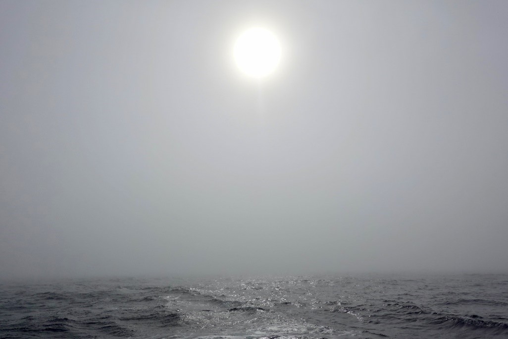
I’ve had time in excess during this cruise, given that our transit was a substantial eight days from Woods Hole to the Irminger Sea, and most of my work on the ship had to do with CTD casts. Yet for this whole time, there have been very few moments of silence, maybe three colorful sunsets, and only a few days of smooth waters. The sun has been coming out more recently – my new favorite color is just “ocean” – but for the most part we have been in a dense fog on choppy seas. The result is a veritable cocoon of water, both underneath and around us, narrowing the possibility of sight to what is right in front of you. Still it is amazing what you can see in that tiny bubble – fin whales approaching from the starboard side! Fulmars flying behind! The buoy is bobbing away into the fog, can you see it go? I love it.
As a first-time sea-goer and student, I have learned so much and had my eyes opened to some pretty amazing work. It has made me think a lot about the reciprocal relationship of humanity to the seas, a relationship which still contributes to the sustainability of the global population today through providing opportunities for livelihoods and resources. However, as we already know, it has been impacted by climate change. There are rising sea levels already posing a real danger to millions of people, on top of the decimation of marine ecosystems and biodiversity.
There is an idea that I love, that climate change impacts life on the planet, but not the existence of said planet. It is a horrific tragedy, the destruction our species is wreaking, but I find there is something comforting about the knowledge that the planet, and its oceans, will be around a lot longer than we can comprehend. The permanence of it all is awe-inspiring. It’s an idea that has big implications and is a little hard to wrap one’s head around sometimes. But it becomes a lot easier to get the point when on a not-insignificantly sized vessel, getting rocked around by 3-meter waves, which in the grand scheme of things isn’t even that bad.
That being said, it’s obvious that the destruction of life on this planet is awful. So it gives me hope that people are actively working to study and preserve the ocean and its systems. The operations carried out by the teams aboard the Armstrong are complex and difficult, but so far have been
conducted with a capability and efficiency that are most admirable. From the deck crew to the Chief Scientist, the impression is of a well-oiled machine actively working to ensure the scientific community and the public have access to the best data possible. Oceanography is a very special facet of that human-sea relationship: a way of understanding, but the ocean fights you while doing it. You have to earn the knowledge, which I think is quite beautiful.
I like knowing that while we may be floating in our little fog bubble in the Irminger Sea, the implications and impacts of the work being done here are far-reaching and important. Thus far, I have had one of the best months of my life. The ocean is certainly inspiring, both of fascination and a healthy dose of fear, and I am glad to be a part of at least a small part of the work being done to understand it better.
June 13, 2024 – The first rough seas of the trip. Image taken from the starboard side of the ship, facing the bow. Seas this day were an average of 2.5m.
June 13, 2024 – Waves crashing over the side of the ship as work is being done on the CTD/Niskin rosette. Sampling in these conditions is not for the faint of heart!
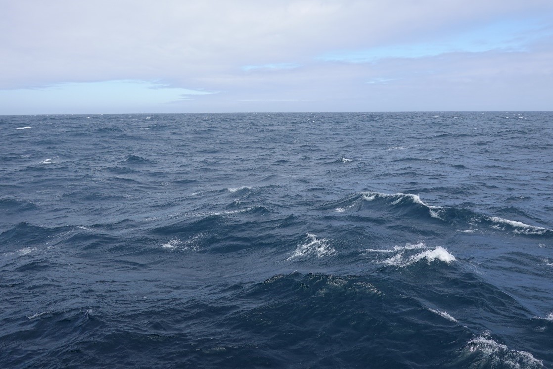
June 13, 2024 – Panoramic view of the waves during the middle of the day. Fast winds make for the whitecaps on the waves.
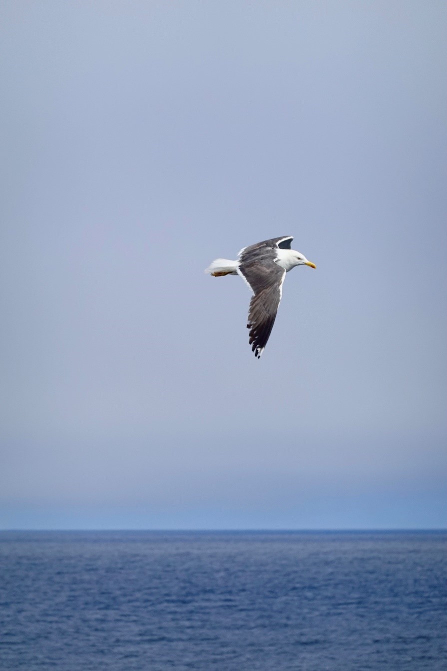
June 16, 2024 – Even though they don’t like to land on the ship, the sea birds frequent the skies and seas around us. Sometimes they get close enough to see every feather!
June 20, 2024 – Occasionally the sun will be out during the day, but tends to go away in the afternoon behind fog. On this day, the clouds were broken enough to see some light, and the clouds ended up looking like an abstract version of the Northern Lights.
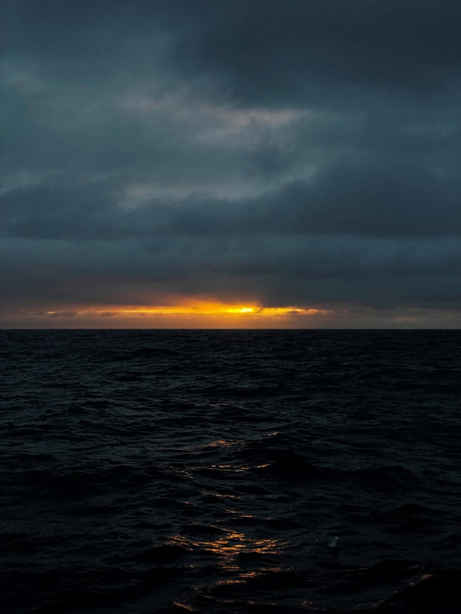
June 20, 2024 – This far north, the skies may not have the traditional orange sunsets, but the purples are just as beautiful. The rarity of having a colorful sunset just makes you appreciate it even more!
June 21, 2024 – My new favorite color is “ocean”. On this day, the sun came out in slivers, but lit up the sea so that it became a beautiful blue/purple/silver color.
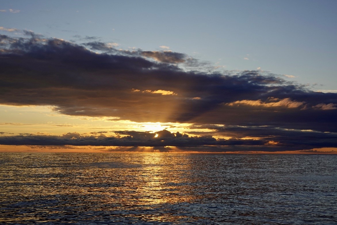
June 03, 2024 – the last “real” sunset of the trip, on our second day at sea. Ever since then, we have been too far north to really see the sun go down at a reasonable hour.
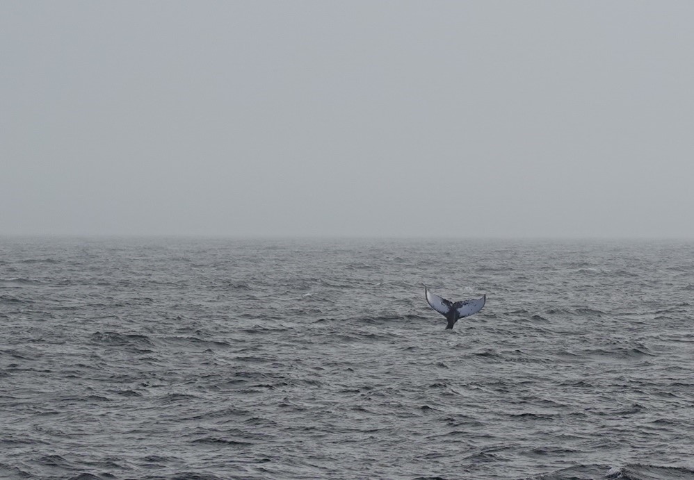
June 04, 2024 – A humpback whale flips its tail up at us as we sail past.
June 06, 2024 – The dense fog creating a grey wall. But it’s beautiful in its own way.
June 22, 2024 – Sometimes the sun peeks through if you can catch it at the right time.
Neil Armstrong – Woods Hole
By Emma Brown, Boston College student
We arrived in Woods Hole! We immediately began lashing down anything that exciting seas might send sliding. This included various boxes of scientific materials, including our toolbox, with bungee cords and ratchet straps. Our filtration system was placed on a sticky mat and bungee corded in both directions. Other boxes, some meant to hold future samples, were lashed in place in the cooler atop metal racks.
This morning, all hands were on deck to help board stores! A large crane lowered cloth nets bulging with boxes of goods into the ship, directed by crew members in hardhats. Once the goods had reached the floor, these crew members freed the net from the holding hooks and cut the boxes loose from their plastic packaging. Then, almost all crew members and scientific personnel formed a passing chain to help load frozen, refrigerated, and fresh stores onto the Neil Armstrong. The process was amazing! Everyone worked as an oiled machine as the galley quickly filled with boxes upon boxes of assorted goods. Our second mate, Chrissy, worked as fast as she could to fit these boxes jenga-style into a food elevator to put them into the ship’s massive freezer/refrigerator.
We began our journey across the Atlantic! We were on the boat by 9 am and met for a team meeting and safety training at 10 in the main lab. The 1st mate, Chris, explained the protocols for fire and abandoned ship. Ayden demonstrated how to don a life-saving wetsuit. It’s not very complicated after you’ve been shown how to do it (I also had to try mine). I was just a half inch too tall for a small- apparently, they’re made for people exactly 5’4 and under. The next size up must be made for people about eight feet tall because I was practically swimming in it. One must lay this suit on the floor to climb into it, one limb at a time. Chrissy, the third mate, helped me get my arms and legs inside. The suit may be zipped up past one’s chin and a strap is placed over the lower part of one’s face. The final step is to squeeze all the air out by crouching and hugging one’s knees. The suits are enormous and clunky beyond imagination, but life-saving in an emergency.
At noon precisely, the boat was pushed away from the dock and we all waved goodbye to those we were leaving behind on land. Following departure, we did drills for emergencies. For a fire, everyone met in the main lab. For abandoned ships, top bunk people rendezvoused at the port side of our vessel and bottom bunk people convened at the starboard side. Later in the evening, the boat stopped for our first CTD cast! In hard hats, steel-toe boots, and bibs (foul weather gear, lacking the jacket), we undid the ratchet straps anchoring the CTD in place on the deck. A well-oiled crane picked the CTD up on a thick cable. The tension in the cable was visible via a screen well over our heads. The tension rapidly increased as the CTD was lowered over the water. We popped all of the Niskin bottles open on top and bottom. These “fired”- aka, closed- once the CTD reached the desired depth at 165 meters down.
The machine was then slowly pulled back to the surface on its cable and gently lowered onto the boat, dripping seawater. We quickly strapped it back to the deck. Then, we tested each bottle to be “leakers,” meaning it’s a Niskin that did close properly on the way up therefore, it’s bad water and can’t be used for science. We took samples for DOC (dissolved organic carbon) and POC (particulate organic carbon). Both involve rinsing the sampling bottle and cap out 3x, then filling to the top with seawater from the desired Niskin. Immediately after, in the lab, we practiced filtering both types of samples.
Photo: The author spends free time on the transit painting and drawing each day.
MSM129: St. Johns, Canada to Reykjavik, Iceland
The blog of the cruise can be found here (German & English): https://www.oceanblogs.org/msm129
Chief Scientist: Johannes Karstensen
Co-chief scientist: Fehmi Dilmahamod
The journey begins
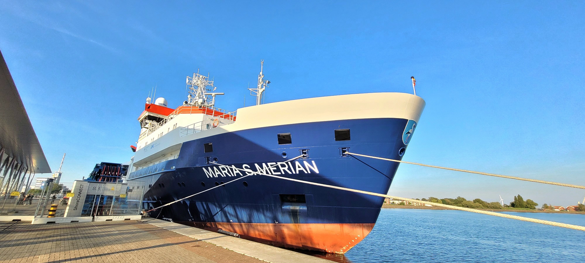
Maria S. Merian in the harbour of Warnemünde (Photo: Abed Hassoun)
It’s time for the Maria S. Merian to embark on the research mission MSM129. In the first part of this mission, the ship will cross the Atlantic—starting in Warnemünde and reaching St. John’s in Canada around 10 days later. In the second part, it will travel from St. John’s through the Labrador Sea to the tip of Greenland and then on to Reykjavik. This blog will accompany the research ship and its inhabitants throughout the journey, providing you with insights into the research and life on board.
So let’s start with the first part of the journey and the question of what the goal of this research trip is.
On every research trip, the respective research groups bring their own measuring devices that they need for their projects. At the same time, there are also devices permanently installed on the ship. Fixed sensors collect information about surface water temperature, salinity, and chlorophyll, as well as current speed. The German Marine Research Alliance (DAM) has made it its mission to preserve and make these underway data (so-called because they are measured while underway) long-term and sustainably usable for science and society. This includes, among other things, quality control and the provision of the data in near real-time.
This expedition focuses on these underway data and has become the main reason for the research trip. The special aspect of this is that data management staff, who normally work from land, will join the scientists on site. The goal of the trip is to optimize the processing and provision of the underway data. Several institutes are involved in this task: MARUM in Bremen, Alfred Wegener Institute in Bremerhaven, the Institute for Baltic Sea Research in Warnemünde, the Institute for Chemistry and Biology of the Marine Environment in Wilhelmshaven and the University of Oldenburg, as well as the GEOMAR Helmholtz Center in Kiel.
We left the port of Warnemünde on May 25th in the best weather. By now, we are already a bit further away from the coast and have experienced the first thunderstorms. Not all measuring devices are switched on yet—some cannot be used all the time and everywhere because, even on the water, national borders must be respected. On our way through the Kattegat, Skagerrak, and along the east coast of Great Britain, we cross several national waters. Only in international waters are we allowed to turn on all the measuring devices permanently.
The FerryBox
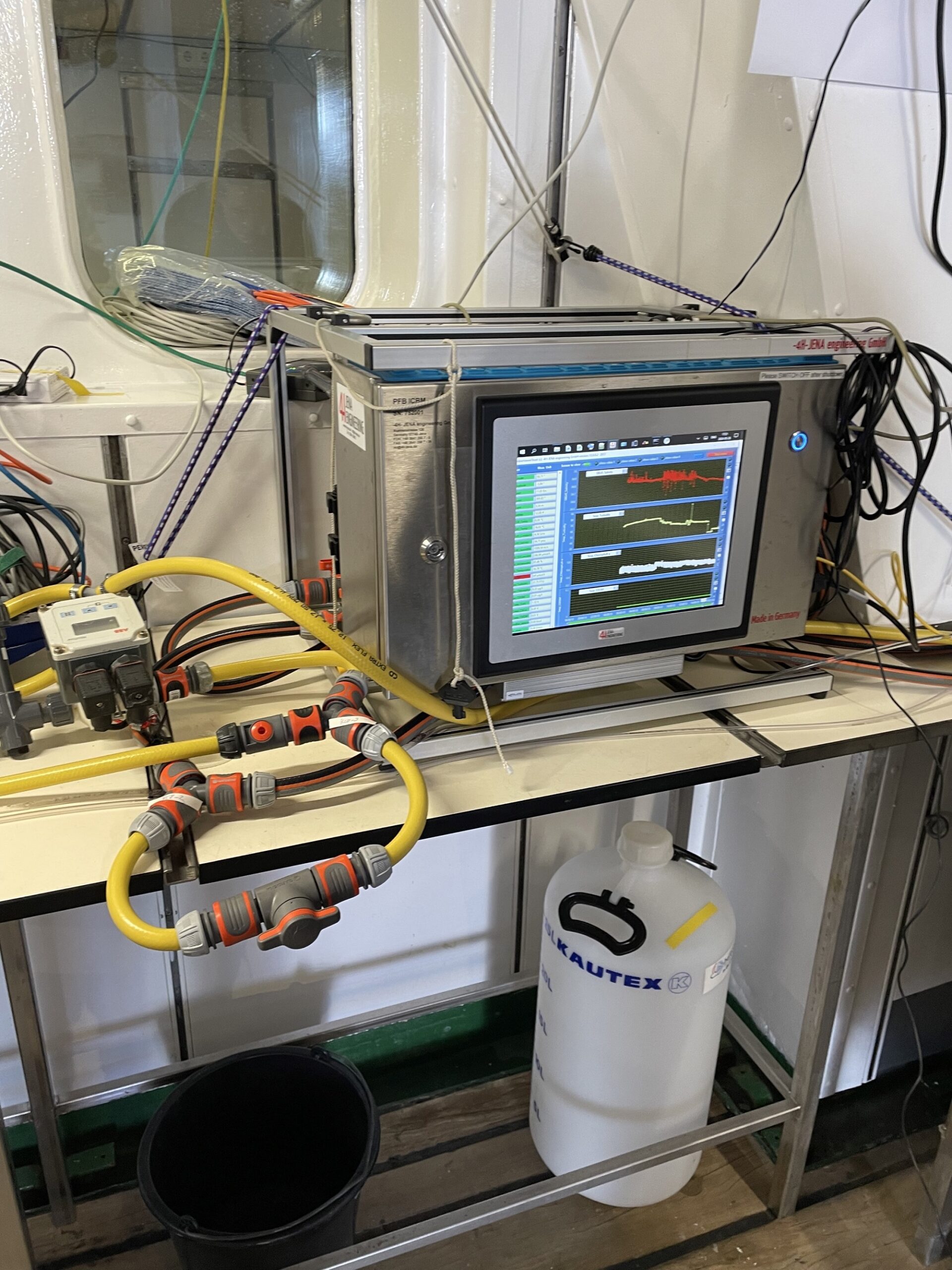
FerryBox (Photo: Christiane Lösel)
Today we accompany Julia from the Institute of Marine Chemistry and Biology of the University of Oldenburg in her work on the Maria S. Merian. The last post was a bit about the underway data, which are measured on ships. Julia brought with her another device that also falls into this category: a FerryBox.
The FerryBox is a so-called flow device. This means that water under the ship is sucked in with a pump and passed through the device. The instrument can then measure the temperature and salinity of the water. These two quantities are important because they determine the density of the water and thus provide information about currents. In addition, the device also measures bio-optical values, namely chlorophyll A and CDOM (Colored Dissolved Organic Matter). Chlorophyll provides information about how much phytoplankton is present in the water. Phytoplankton are small algae that form the basis of the entire marine food web. The great advantage of the Ferry Box is its modular structure. For example, sensors for total alkalinity (how much acid the water can bind), carbon dioxide or PH value can also be added.
So these are all important variables for understanding processes in the ocean. But why is the device on board and where does the name FerryBox come from?
Maybe we’ll start with the declaration of names. The FerryBox is meant to be used on ferries. Ferries are good for carrying measuring instruments, as they regularly travel the same distance. The FerryBox is a box-shaped device that can measure autonomously and only needs to be maintained by a scientist from time to time.
The main objective of this first part of the research trip is to optimize the transmission of data from measuring instruments to land. The FerryBox can be seen as an example of this. Julia brought them aboard and, together with Norbert from the Alfred Wegener Institute, is now making sure that the data is transmitted to shore in near real-time. When she is back ashore in her office during the second part of the research trip, she can retrieve the data from her computer. If an error should occur, she can notify the ship directly so that the problem can be rectified immediately. Julia also calibrates the FerryBox. To do this, she passes water samples through a filter in the lab and then stores them in a refrigerator with a temperature of -80°C. This means that the samples remain stable until they are subsequently evaluated in a laboratory in Germany.
In the end, the developed software should be usable as a blueprint for other devices. The near real-time data is then also publicly visible and can be used by anyone.
Seamounts
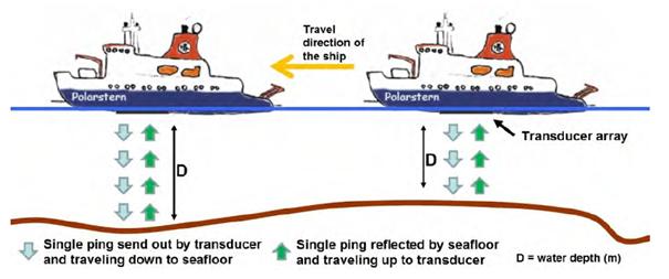
Scheme explaining the echo sounder (Damaske, 2013)
If you go on a hike in the mountains, you usually look at a map as the first step. It is also important to have a map of the ocean. Not only a map listing the coasts and islands, but above all a detailed map of the topography of the seabed. During the middle of the 19th century to the beginning of the 20th century, depth measurement was still carried out with a weight at the end of a long rope, but today the echo sounder patented by Dr. Alexander Behm from Kiel in 1913 is used in most cases.
The most accurate and scientifically recognized bathymetric data collection is produced by GEBCO (General Bathymetric Chart of the Oceans). The dataset is based on collected data from vessel depth measurements and was first presented to the public 120 years ago. Today, this data set consists largely of so-called predicated bathymetry. This means that satellite measurements are made, which can then be verified and supplemented with bathymetry measured by ships. The satellites can derive from the measured sea level via various physical relationships whether a seamount is underwater. This method allows us to map the entire ocean, but it is very inaccurate. Seamounts less than 2 km in size, for example, cannot be measured. The GEBCO dataset is now renewed every year. The only drawback is that it lacks detailed metadata. Metadata is background information indicating, for example, by which institute or on which vessel the data provided were measured.
Since the data set is largely based on ship measurements, it is highly dependent on ship routes, some of which have very large gaps. Only about 20% of the seabed has been measured in this way (Mayer et. al 2018). On this journey, we want to map some of these gaps. More specifically, we want to map so-called seamounts.
Seamounts are submerged mountains of volcanic origin. They are typically conical, often with craters, linear ridges or shallow peaks. The shape often depends on the origin of the seamount. They are formed in places where tectonic activity occurs, such as near oceanic ridges, arch islands, or at places where hot material rises from the Earth’s mantle beneath the tectonic plate. Seamounts that form near plate boundaries, i. e. where the lithosphere (the Earth’s crust and the outer part of the Earth’s mantle) is still fresh and thin, tend to be rather small. Small in this case means less than 2. 5 km altitude. Larger seamounts with a height of 3-10 km often form in places where the lithosphere is older and thicker. Although it is not known exactly how many seamounts there are, one thing is certain: there are many!
Due to their volcanic origin, seamounts are very interesting from a geological point of view, as they can provide insight into the composition and temperature of the Earth’s mantle. Seamounts are also important for oceanographic observations, as bathymetry influences currents and mixing processes. Seamounts can act as barriers that prevent cold deep water from mixing with warm surface water. Finally, they are also the centre of a diverse ecosystem. This is because nutrient-rich deep water rises at their flanks (a process called upwelling) and thus forms the perfect basis for fish and diverse flora and fauna.
So now we know why we should be interested in seamounts, that there are many of them out there, and that a lot of them have not yet been mapped.
On our planned itinerary we pass some places where seamounts are suspected. By only slight course changes it is possible to drive over some of these seamounts and to measure them with the ship echo sounder. An acoustic signal is sent to the seabed, which is reflected on the ground and then received when returning to the ship. Thus, the measured time between sending and receiving can be used to measure the distance between the ship and the seabed. This principle is also used here on the Maria S. Merian, with the difference that not only one signal, but a whole range of signals is emitted. This allows a strip with a width of six times as large as the water depth to be measured. In our current measuring area the water depth is 2500-3000 m which corresponds to a mapped strip of 15 to 18 km wide.
We are at the moment near the Mid-Oceanic Ridge, a place where new lithosphere is forming. As we have already learned, the seamounts to be found here will tend to be smaller. In this area, the number and density of predicted seamounts is also significantly higher. Our first mapped small seamount, still far from the Mid-Oceanic Ridge, showed a shallow peak with an approximate height of 450 m. With 7. 5 km wide and 8 km long, it was almost round and extremely worth seeing.
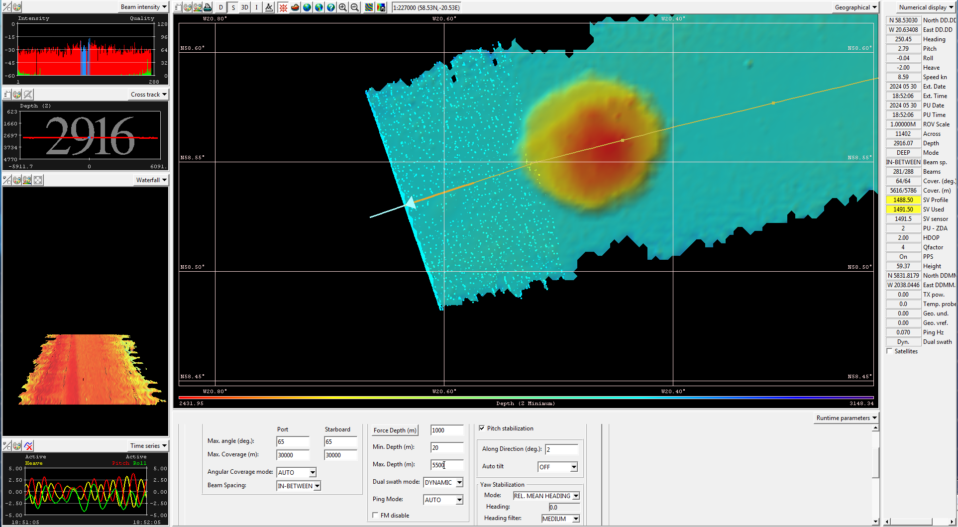
Picture of a Seamount measured during this cruise
On this trip, Daniel and Marianne from the “Underway” research data project of the German Marine Research Alliance (DAM) will take care of everything that has to do with the seamounts and the Multibeam Echo Sounder. Frequently, Multibeam data is collected even if the focus of the research is not in the measurement of the seabed. As part of the project, Daniel and Marianne worked to collect these data and make them available to scientists after the research trip. Both are part of PANGAEA, a data repository for earth and environmental data.
Sources:
- Gevorgian, J., Sandwell, D. T., Yu, Y., Kim, S.-S., & Wessel, P. (2023). Global distribution and morphology of small seamounts. Earth and Space Science, 10, e2022EA002331. https://doi.org/10.1029/2022EA002331
- Mayer, L.; Jakobsson, M.; Allen, G.; Dorschel, B.; Falconer, R.; Ferrini, V.; Lamarche, G.; Snaith, H.; Weatherall, P. The Nippon Foundation—GEBCO Seabed 2030 Project: The Quest to See the World’s Oceans Completely Mapped by 2030. Geosciences 2018, 8, 63. https://doi.org/10.3390/geosciences8020063
- Damaske, D. (2013): Bathymetry and short term changes of submarine seafloor structures in the area of the former Larsen ice shelf, north west Weddel Sea, Master thesis, http://hdl.handle.net/10013/epic.67a7bbd6-5ada-4764-a961-519e334d5c56
- https://oceanexplorer.noaa.gov/facts/seamounts.html
Goodbye green, Hello deep ocean blue
By H Furey
The 2024 OSNAP field season is underway. The R/V Armstrong departed her homeport of Woods Hole on 02 June 2024, loaded with gear, and bound for the Irminger Sea. The ship will spend the summer in the subpolar North Atlantic, in support of OSNAP and other science programs. The next time the Armstrong will be in home will be in November.
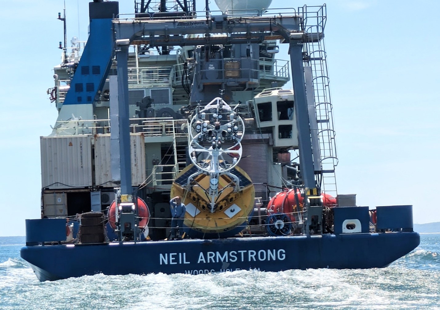
Photo: I look out from the fantail as the R/V Neil Armstrong departs from Woods Hole. Goodbye land, goodbye Cape Cod summer, goodbye green, goodbye flowers and nesting birds. See you in a while. (Photo by Dave Fisichella, WHOI.)
I’m thankful to be with this crew, on this ship, and with this science party. It’s been a year since I’ve last been to sea, and then, in the Indian Ocean in support of a different project. Our OSNAP component is supported by Adam Houk (WHOI) and me, with help from Meg Yoder (Boston College). We travel with the NSF Ocean Observing Initiative (OOI) crew who are turning the Global Irminger Sea Array (https://oceanobservatories.org/array/global-irminger-sea-array/). The term ‘turning’ means to recover the moorings and instruments currently in the water and deploy new moorings with fresh instruments. For the OSNAP portion of the cruise, we are turning the moorings east of the Greenland shelfbreak (OSNAP ‘GDWBC’ moorings M1, M2, M3, M4). OOI supports OSNAP in that two of the OOI moorings are inline with the OSNAP array, and the OOI mooring data are used in the OSNAP transport, heat, and freshwater calculations. We lean on the other science personnel and students onboard, who help mightily to get the OSNAP moorings recovered and re-deployed, instruments calibrated, CTD casts collected, water sampled and analyzed. In turn, we help them as we can during their mooring and hydrography operations. We have a few more days of steaming north to deep water, and then the work begins.
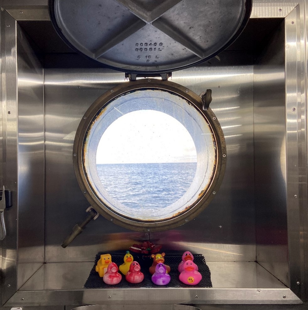
Photo: This year Harry Burnett, our Chief Steward, has a collection of ducks in the galley window.
Cruise Report AR69-03
By Fiamma Straneo
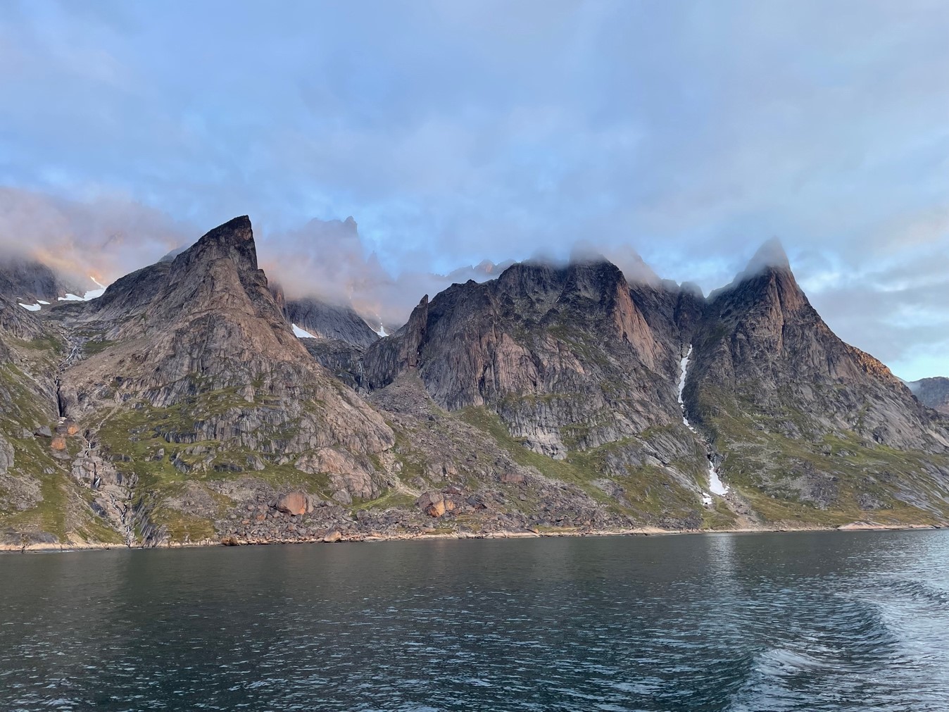
An awakening of gusty winds and capricious waves
Replace images of Reykjavik
Hesitant movement on the ship as we abruptly begin
Steam, Stop, Sample
Rollercoaster at the surface mirrors the spires of the mid-Atlantic ridge beneath us
As we head across the Irminger Sea
Steam, Stop, Sample
A rhythm slowly unfolds
Steam, Stop, Sample
Waves become longer and movements less hesitant
Sensors pierce through young and old waters on their way down
Warm waters, suggestive of tropical climes
Give way to cold, newly formed mid-depth waters and
Look! The deep waters from the Iceland-Scotland Ridge
Crawling at the bottom, invisible to the surface
The essence of the overturning circulation
Text book learning turns into experience
Steam, Stop, Sample
Until the end of the line
Marked by Greenland’s jagged mountains
Here icebergs with mesmerizing shapes drift in cold, clear waters
Every now and then a glacier comes into view

Turn back to pick up buoys left behind last time we were here
Steam, Stop, Release
Hoping they will cede to our call and drop their anchor
Hoping to be the first to spot them as they pierce through the surface
Waiting turns into excitement.
Steam, Grapple, Hoist
Help the heroic instruments back onboard
Scrub them clean of temporary dwellers
Before greedily listening to the stories they tell.
Two years inside the overturning.
Steam, Stop, Release
Steam, Grapple, Hoist
A rhythm slowly unfolds
As the instruments pile up on deck
Flurry of laptops, cables, instruments
Young scientists turned overnight into crusty, able oceanographers
Until, one of many low-pressure systems scurrying across the Atlantic,
Stalls Over Us
Roll, Tie-down, Roll
Toes wedged between wall and mattress anchor us during sleep
Water floods across the deck
Pilot whales surf in the waves by the ship beckoning
Then just as it came the storm leaves
Leaving sunshine, icebergs, glaciers and northern lights
Steam, Stop, Sample
Deep canyons guide tropical waters towards the ice
Steam, Stop, Sample
Time to head back to the buoys
Steam, Stop, Release
Steam, Grapple, Hoist
Every buoy replaced by a twin
For more stories in two years.

We cross to the Labrador Sea through a steep-walled shortcut
Here it all repeats
Steam, Stop, Sample
Steam, Stop, Release
Steam, Grapple, Hoist
A rhythm slowly unfolds
Backdrop of southwest Greenland’s gentler peaks
Crane stops working.
Intermission filled by acrobatic flights of dark-eyed fulmars
Crane fixed.
Steam, Stop, Sample
Sensors piercing waters cold and warm, fresh and salty
And deep down the dense waters again.
Crawling at the bottom, invisible to the surface
Steam, Stop, Sample
Vials of precious salty waters packed in endless boxes with little numbers
Some emptied into alchemic alembics
The vials too tell stories.
This time of origin and happenings along the way
Steam, Stop, Release
Steam, Grapple, Hoist
Every buoy replaced by a twin
To measure for two more years
At night different canyons drive same swirling currents

Steam, Stop, Sample
In the day
Steam, Grapple, Hoist
At night
Crane breaks. No fix this time
Pause nonetheless to watch great shearwaters wing-dipping in cold water
Without a crane weights are dragged on deck
Until all the twins are deployed.
Take a break in the icy, flat waters of a fjord before heading out into another storm

Cape Desolation beckons us with its submerged rocks and mountains
Whale spouts in the distance and stiff wind ahead
Forty knots gusting fifty
Fifty knots gusting sixty
This is the North Atlantic after all
Roll, Tie-down, Roll
Steam, Stop, Sample
White waves bounce us in the dark.
Until time’s up
And the lights of Nuuk’s bustling harbor appear
Hesitant movement on land after 37 days at sea
Ocean data, recently declared world heritage,
Tucked deep in our pockets in a small hard-drive
A giant effort by a ship, 17 scientists and 22 crew
A small step forward for overturning science
To be continued to provide answers
twin buoy after twin buoy
vial after vial
one crusty oceanographer after another.
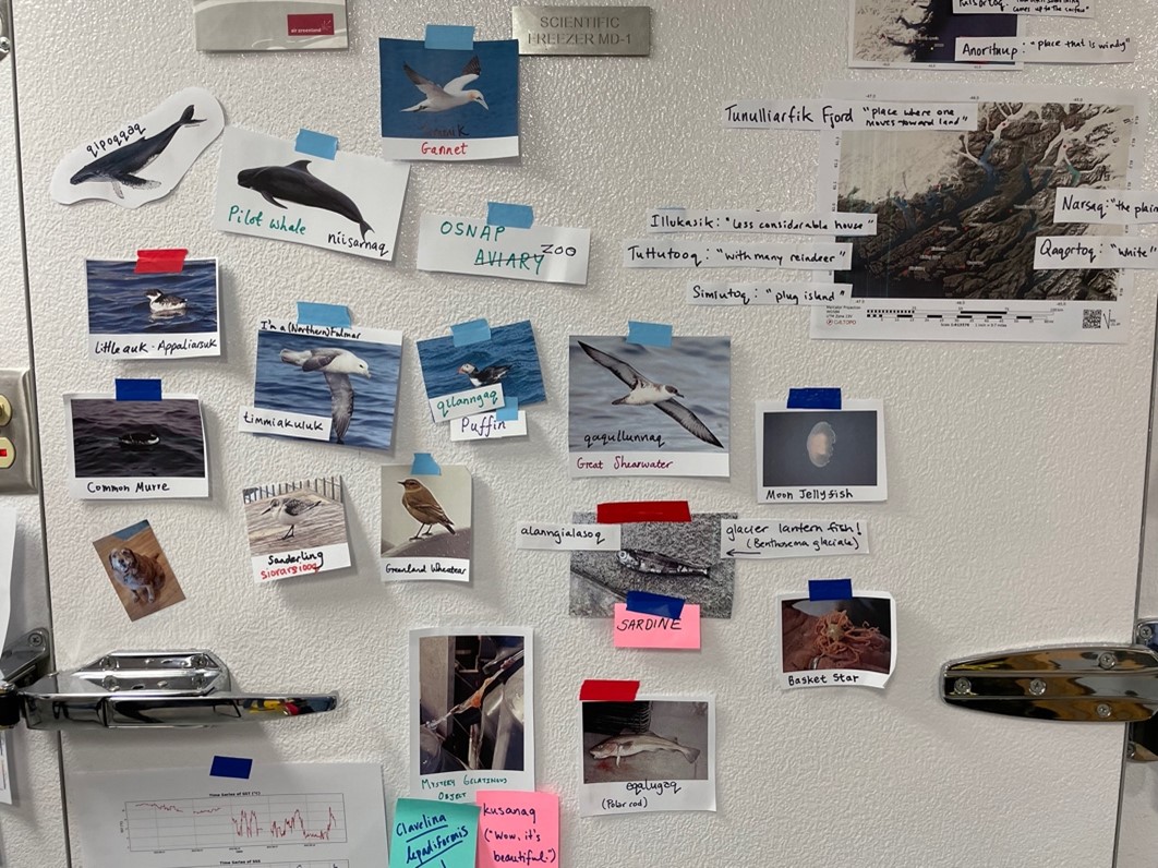
The OSNAP zoo
By Donald Slater
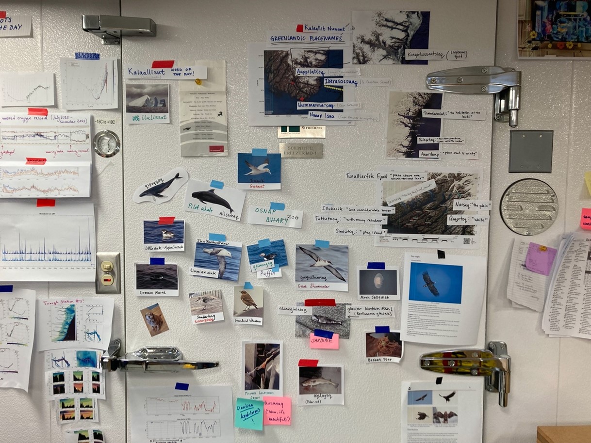
The walk-in fridge in the main lab of the RV Neil Armstrong has for the past 5 weeks functioned as anything but a fridge. With storage space at a premium, it has hosted much of the moored instrumentation, including the microcats that measure ocean temperature and salinity, and the aquadopps that measure ocean velocity. The door has further become a pinboard for the birds, whales and mystery gelatinous objects encountered on our travels, collectively known as the OSNAP zoo. Before diving into the individuals that inhabit the OSNAP zoo, I’ll note that Aurora Roth has found Greenlandic names for many of the species and locations, which are noted in parentheses.
Starting with the birds, we do not count among us any ornithologists of great repute, so all identifications should be taken with a pinch of salt. Speaking personally, it is at the relatively tender age of 32 that I find myself at the top of the slippery slope that leads to spotting scopes, but I have been ably assisted by enthusiastic colleagues. We steamed out of Reykjavik on 19 August accompanied by bold gannets (timmik) and shy puffins (qilanngaq), the latter clumsily shooting under the water at the first sign of the boat. We picked up some great shearwater (qaqullunnaq) during our transit of the Irminger Sea, before proximity to southeast Greenland brought sightings of little auk (appaliarsuk) and common murre. While sheltering in the mouth of Tasermiut Fjord in southwest Greenland we were graced by a magnificent white-tailed eagle, and once further offshore, kittiwake.
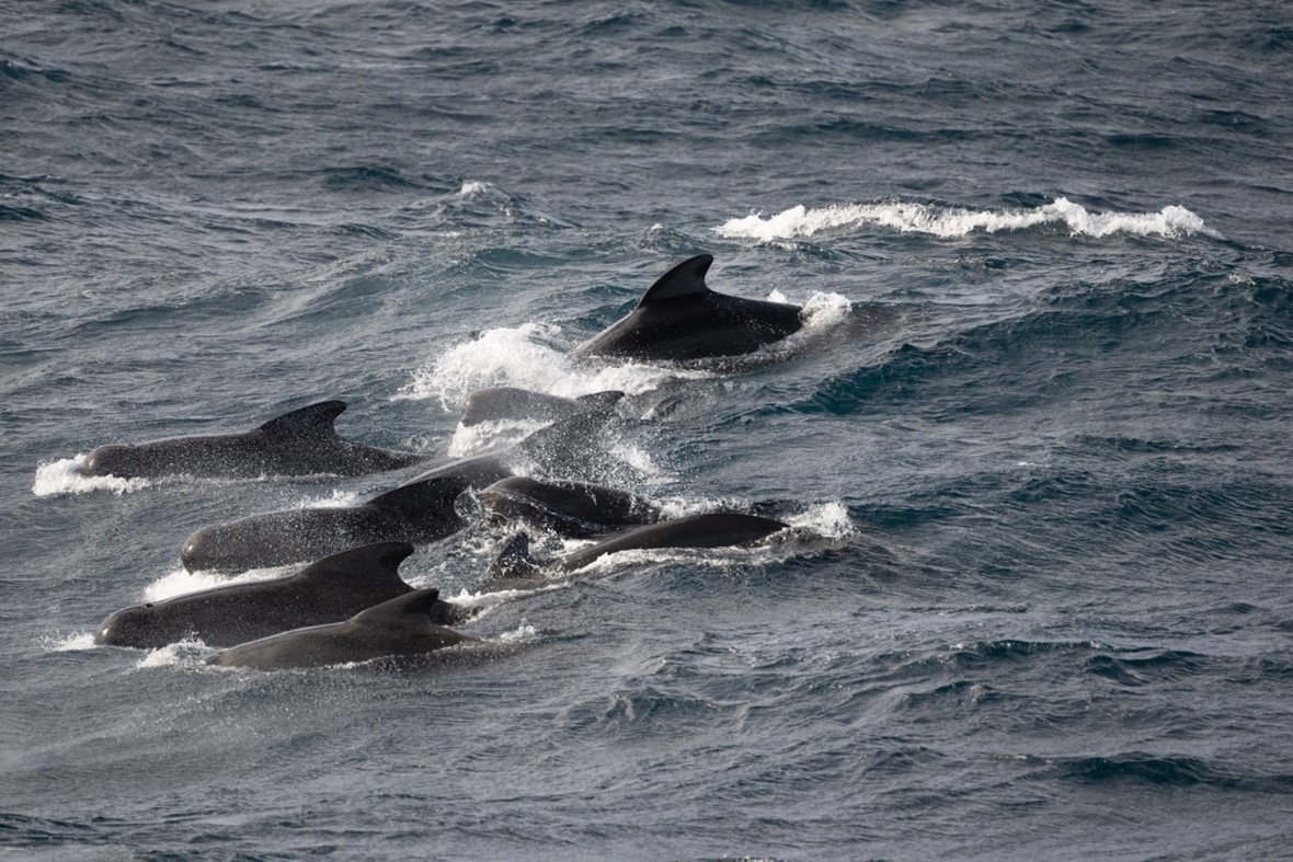
What started out as an OSNAP aviary rather quickly became a zoo with the sighting of pilot whales (niisarnaq) on 22 August in the central Irminger Sea, where a huge pod appeared to be playing together in the waves for a number of hours. Pilot whales have been perhaps our most frequent sighting, but we’ve also glimpsed seals, orca, humpback and fin whales, most commonly on the east rather than west coast. The crew on the bridge of the boat are always the first to spot a whale, and often kindly radio down to the science lab where there is then a scrambling for jackets and binoculars.
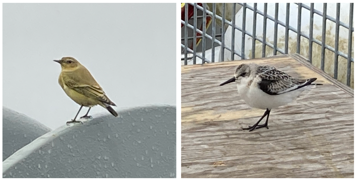
Some creatures have been brought out of the ocean against their will. While in Ikerasassuaq (Prince Christian Sound) one of the crew caught some Atlantic cod that constituted dinner that evening. A great variety of life has emerged from the ocean on our recovered moorings, including basket stars and many hard to identify gelatinous creatures, some apparently found to be clavelina lepadiformis. We’ve also had some smaller birds temporarily increase the number of boat inhabitants beyond 39 humans. In late August, during a storm with winds of 50 mph and waves over 4 m, a small group of Greenland wheatear found refuge on the bow of the Armstrong, but sadly perished a few days later. In early September, while over 70 miles offshore in the Labrador Sea, we were visited by a sanderling (siorarsiooq), who surveyed the boat for a few hours before deciding it preferred its own company.
Our most constant companions, however, have been fulmars. Since leaving Reykjavik harbour to the time of writing near Cape Desolation, there has not been a moment without fulmars in view, so that it would be easy to believe the same fulmars have followed us every step of the way. Fulmars constitute the first chapter of The Seabird’s Cry by Adam Nicolson, a book that Fiamma will recommend to anyone who will listen, and which describes fulmars as “wind-runners, wind-dancers, the wind-spirits, alive with an evolved ability to live with the wind, in it and on it.” This has certainly been our impression from the boat – the fulmars coming into their own on particularly windy days, when they like to glide from the stern to the bow within touching distance of the boat, then wheel away with dramatic acceleration out into the ocean before looping around behind us to repeat the acrobatics.

Within a few days we’ll arrive in Nuuk and touch our first land for 36 days. This brings mixed feelings from relief at the freedom of leaving the boat to the sadness of the end of a unique experience. The walk-in fridge in the main lab of the RV Neil Armstrong, having temporarily hosted a thriving ecosystem, will go back to being a walk-in fridge.
[Greenlandic animal names may be found at https://oqaasileriffik.gl/en/terms-of-greenlandic-animals/]
When the science stops
By M. Yoder, Boston College
We boarded the R/V Neil Armstrong as scientists on a mission to collect data and redeploy moorings, and while someone is on shift and working 24/7, it’s not all of us at the exact same time. So, what goes on when we’re not deep in the action? Many of the questions we’ve fielded from friends and family are ones we ourselves wondered prior to getting underway. For future oceanographers and the generally interested, read on to find some of the answers to sea-going’s most mysterious questions!
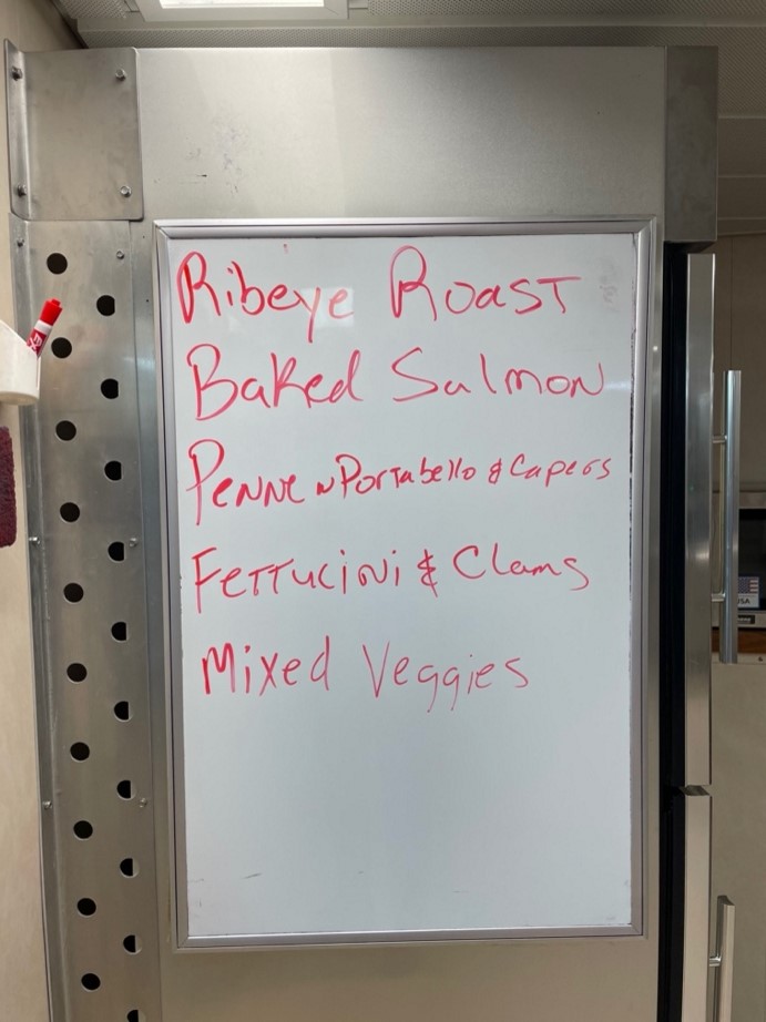
What’s the food like?
In a word, delicious! It would take literary skill far above that of my own to do justice to the myriad of foods we enjoy. Galley crew Eric, Bryan, and Tommy keep us well fed with a rotating menu of yummy and nutritious meals. Somehow nearly four weeks in there is still fresh lettuce, although more canned and frozen foods are making their way into our diets. Anyone whose shift doesn’t align with all mealtimes can have food set aside with their name on it in a special fridge. In between meals, the mess has an assortment of snacks and beverages you can snag if feeling peckish, plus there is a formal mid-afternoon snack time known as cheese-thirty. There’s a banana bread recipe, that if I’m successful in convincing Eric to give me, might be the most valuable piece of data I collect on this trip. (If my advisor is reading this, I am ~partially~ kidding!)
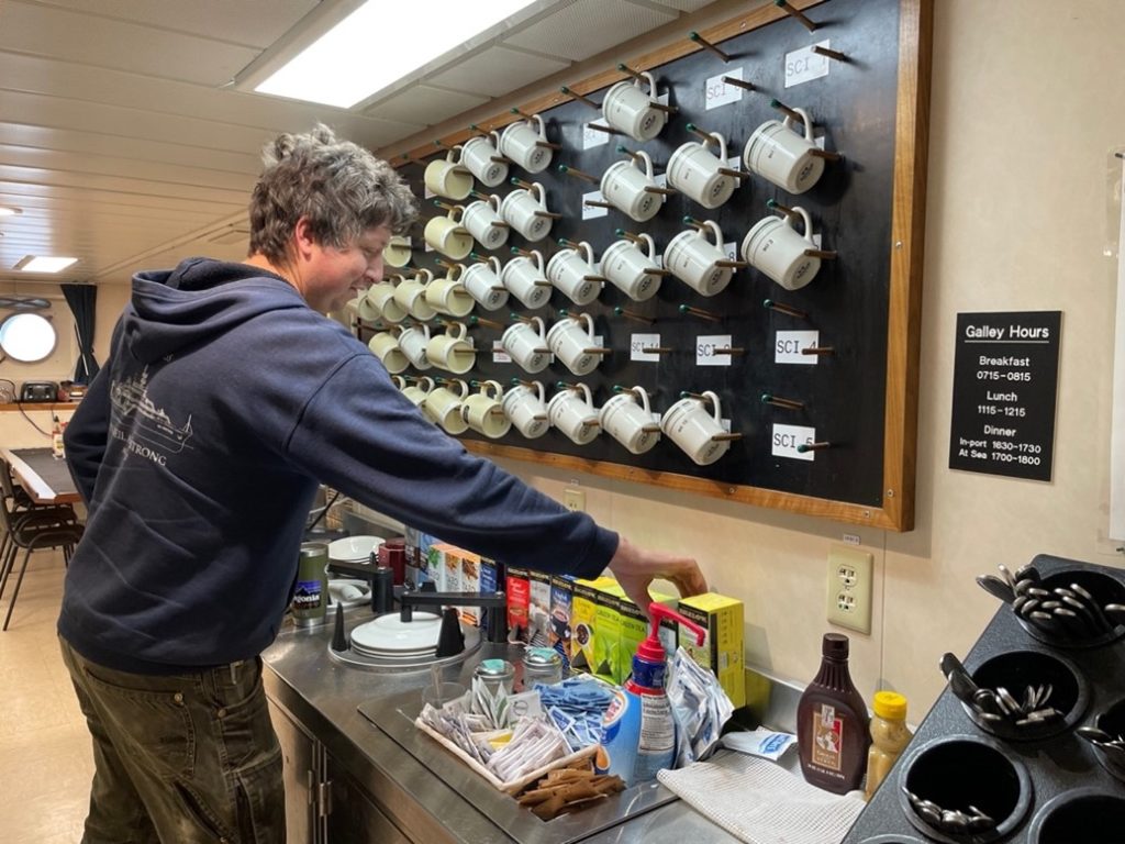
Here, Croy makes some tea at the beverage station. Everyone has their scientist number or crew member title on a corresponding mug, which is your only drinking vessel provided. This allows everyone to take mugs outside of the galley and not mix them up, but also ensures the mugs make their way back, otherwise you won’t have anything to drink out of!
Can you exercise?
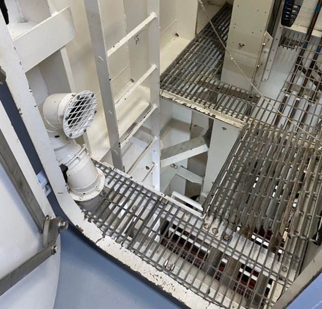
If you’re feeling coordinated! We have access to a well-equipped gym, though you’ll need to descend two levels below the main deck, passing through a watertight door and take a ladder through a trap door. A spin bike, rowing machine, free weights, and two treadmills keep us fit, although it takes substantially more finesse when the ship is rolling. The treadmill in particular is not for the faint of heart, with much discussion about where to hang on in order to get the most land-like workout. Some opt to be vertical pole holders, while others channel their inner parent pushing a child in a jogger, and the boldest go tentatively hands-free.

Do you have internet?
Yes! Which you may have guessed considering we posted this from the ship. We each get 2GB of data through the ship’s WIFI every day, a big upgrade from the 1GB on prior 2022 cruises and from the 200 MB a day from 2018. The speed is even fast enough for video calls to loved ones back home.
Can you do laundry?
Yes again! The ship has two washers and dryers in a laundry room. College laundry room rules apply, set a timer or you run the risk of annoying your shipmates and having your clothes moved to the next machine or the counter.
Do you get seasick?
We’ve been extremely lucky with the weather this trip and have had relatively calm seas, although we are currently hiding in a fjord to avoid large swells. Most people come aboard with various seasickness medications and take them depending on the sea state (how rough the seas are) and their sensitivity to motion sickness. Something I personally underestimated was not the seasickness itself, but the challenge of normal life while everything is moving. Walking down the hallway or just standing upright can be more entertaining, or more difficult, depending on your outlook. In my opinion, sleeping is greatly enhanced or hindering depending on the sea state; sometimes the roll is gentle and rocks you to sleep, other times you’re bouncing along the waves and feeling your mattress rise and fall beneath you.
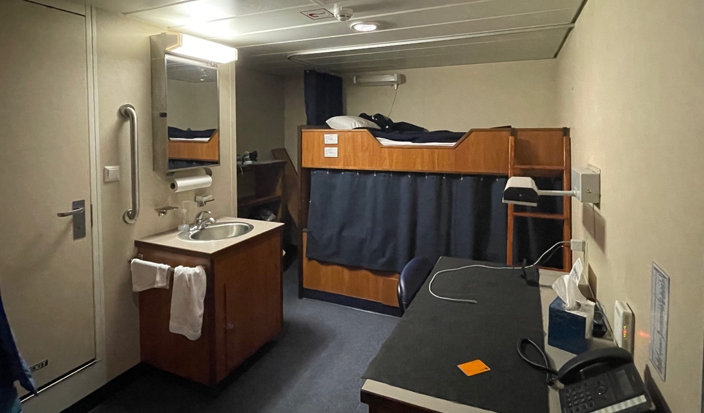
Speaking of sleeping, what are the arrangements like?
Most people share a room with one other person, which has a set of closets, bunk beds with privacy curtains, and a sink. Bedding and towels are supplied. A bathroom with a toilet and shower adjoins with a room next door. For particularly rough weather, there is even a wooden board you can insert between the mattress and frame to prevent the top bunker from taking an unfortunate trip over the edge. Depending on what shift your bunkmate is on, you likely do some getting ready in the dark, either for the day or for bed, and have to adapt accordingly. One technique I’ve employed is pouring the toothpaste directly into my mouth rather than trying to put it on the brush.
Can you go outside? Can you go on land? Can you swim? Do you feel trapped?
Yes, we can go outside and do it quite frequently, with decks on all sides of the shift and a good deal of the science taking place outside. While we’ve been in sight of land many times, we’re not able to set foot on it as we haven’t gone through customs to enter Greenland, plus there is work to be done on the water! Absolutely no swimming, not that you’d really want to in these 5-10°C (40-50°F) waters. I think whether or not you feel trapped on the ship varies day to day and person to person. Some level of claustrophobia and homesickness is inevitable to varying degrees, but luckily there are plenty of wonderful people on board to spend time with, which leads me to….
What do you do for fun?
Lots! First and foremost, I think I can speak generally in saying that we find it very exciting to make preliminary plots of the data we’re collecting and discuss it with one another.
We play games, consisting primarily of group crosswording, some cards, and a complicated game I’ve yet to attempt called Wingspan.
There are plenty of sights to be seen as we’ve been near the coast, admiring icebergs, glaciers, Greenland’s rugged mountains and fjords, sunsets, and the northern lights.
We’ve been seeing a variety of fauna, like pilot whales, puffins, fulmars, and auks. These are logged on the main lab wall with their English and Greenlandic names. We’ve also been learning the Greenlandic names of many places we’ve passed, thanks to Aurora!
I’d be remiss to not mention being greeted by Neil himself each morning on the way down to breakfast. Hopefully, this has given you some insight into the non-science aspects of life at sea!