by Heather Furey
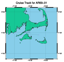
So, we are off (Figure 1). The sun is shining, it is a perfect June Cape Cod day. Lines were cast about 20 minutes early; family and friends were left to rush to the dock to wave goodbye.
We are headed out to ‘tip jet central’, just east-northeast of the tip of Greenland where so many strong wind events are located. The winds scream across the Labrador Sea from the west, round the corner of Cape Farewell at the southern tip of Greenland, into the southwest Irminger Sea, forming strong cyclonic wind events. We partner with Ocean Observatories Initiative (OOI) on this cruise, as they are headed to the same work region to turn around the Global Irminger Sea Array (https://oceanobservatories.org/array/global-irminger-sea-array/). This OOI global array has four heavily instrumented moorings, two of which are in line with the OSNAP array, located between the Greenland Deep Western Boundary Current (GDWBC) moorings.
The entire OSNAP line will be recovered and redeployed this summer – a feat that will require five different oceanographic cruises from three different institutions and five different science parties – led by UMiami, GEOMAR, NOC, Scripps, and WHOI. The cruise details are listed here: https://www.o-snap.org/observations/research-cruises/.
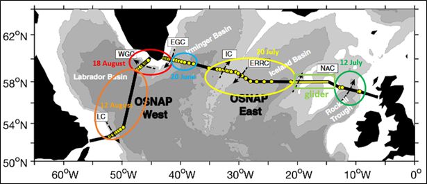
The entire OSNAP mooring and CTD line across the Labrador Sea, Irminger Basin, Iceland Basin, and Rockall Trough is shown in Figure 2. Each of the five cruises will service one of the circled regions. We are headed to the Irminger Sea (blue) now, then the R/V Neil Armstrong will dock in Reykjavik and pick up the next science party, who will service moorings in the Iceland Basin (yellow), then back to Reykjavik, new science party, who will then service moorings east and west of southern Greenland (red). Meanwhile, the folks aboard the British RSS Cook will service the Rockall Trough region (green), and the German RV Meteor will service the Labrador Basin array (orange). The glider array (light green), run by SAMS, continually measures ocean properties across the Rockall Plateau.
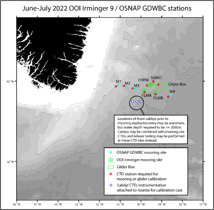
On this cruise, we will be recovering and redeploying (‘turning around’) four moorings and calibrating their instruments (see the blue circle in Figure 2 and M1, M2, M3, and M4 in Figure 3), in addition to the moorings at the OOI Irminger Array (see SUMO, HYPM, FLMA/B, and Glider Box in Figure 3). The work load will be about a 2/3 OOI, 1/3 OSNAP balance. We share some of the science party: hydrographer Leah Houghton, the deck crew led by John Kemp, and help from other OOI members during our mooring deployment or recovery days when they have time. And, in turn, we help OOI out during their work days as we can.
We have just finished a test CTD cast and reworked the day-by-day cruise plan, which will likely be reworked a few more times as the days go by and actual events reshape the way we spend our time. Just ahead are a couple of transit days to deep water, instrument prep, and then a few calibration casts.
More later, Heather