Category Archives: News

A long road

by Susan Lozier

I have always been interested in advances in science that seemingly happen overnight.  I love the stories of someone walking through the woods when a new idea or solution to an old problem comes to mind, and then the next day he or she tests something in the lab, makes some calculations, or runs model simulations to check things out, and science is rewritten.  

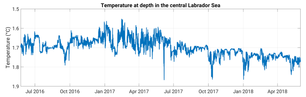
Then there is the slow science of ocean observations, where almost nothing happens overnight.  Take OSNAP, for example.  Our first OSNAP time series will be published in the February 1st 2019 issue of Science, almost 12 years after OSNAP was first conceived.  There is nothing ‘overnight’ about this program.  Not even close.

In July of 2007, I was in Woods Hole, co-chairing the committee for the implementation of the US AMOC Program. At lunch one afternoon, sitting outside of a restaurant on Main Street in Falmouth, Bill Johns, Molly Baringer and I were discussing the success of the RAPID program and the new modeling results that were pointing to the disconnect between AMOC measures in the subpolar and subtropical regions.  At that lunch, the three of us agreed that we needed an AMOC measure of the overturning in the subpolar basin.  And so on that warm July afternoon the OSNAP seed was planted.  

Fast forward three years to April of 2010 when OSNAP was largely planned at a North Atlantic Subpolar Observational Program Workshop, which I hosted in Durham, North Carolina.  While I like to think that the workshop participants remember this workshop because of the beautiful weather, great conversations and exciting science plans, I am aware that many remember this workshop because of the volcanic eruptions in Iceland during our meeting.  Ash from Eyjafjallajökull thwarted many Europeans’ plans to travel back home, and they were stranded in North Carolina for a few extra days.  Considering how lovely spring weather is in North Carolina, it was not a bad deal.

After that planning meeting in 2010, one of the first items on the agenda at the 2nd meeting of the U.S. AMOC Science Team in Miami was to name our new program. We rejected a fair number of clunky nominations until we settled on OSNAP, a suggestion by my then 19-year old son, Joseph, who used this term quite frequently in conversations with his mother. 

At this point, I would be remiss if I did not call out the contribution and support from funding agencies and the program managers at those agencies.  OSNAP would have gone nowhere fast without that support. Dave Legler and Eric Itsweire were instrumental to making the Duke planning workshop, funded by the US AMOC Program, happen.  And Eric (program manager at the National Science Foundation) worked closely with Mike Webb at the UK National Environmental Research Council to coordinate the review of OSNAP proposals on both sides of the Atlantic.

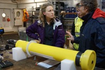
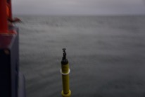
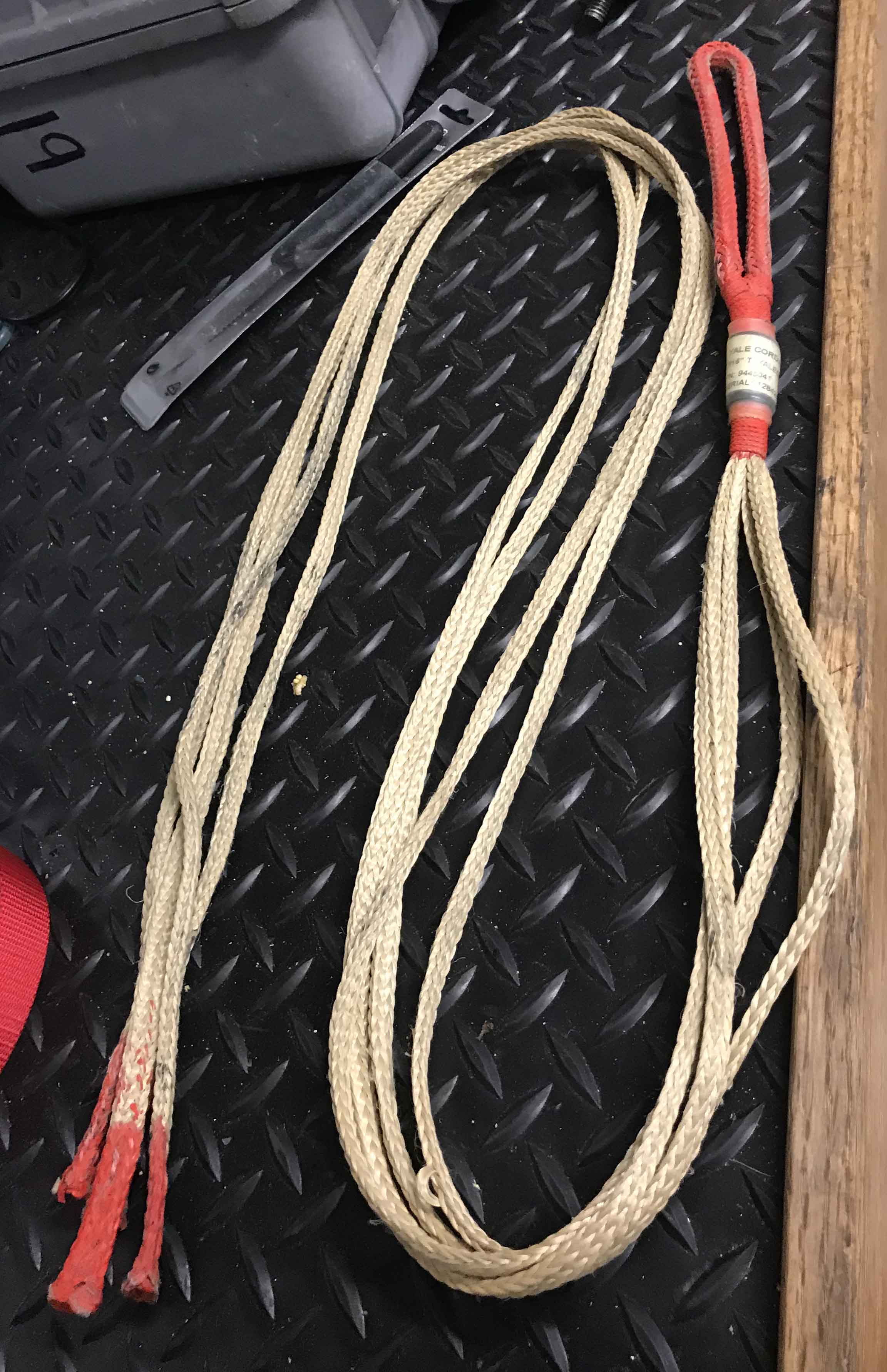
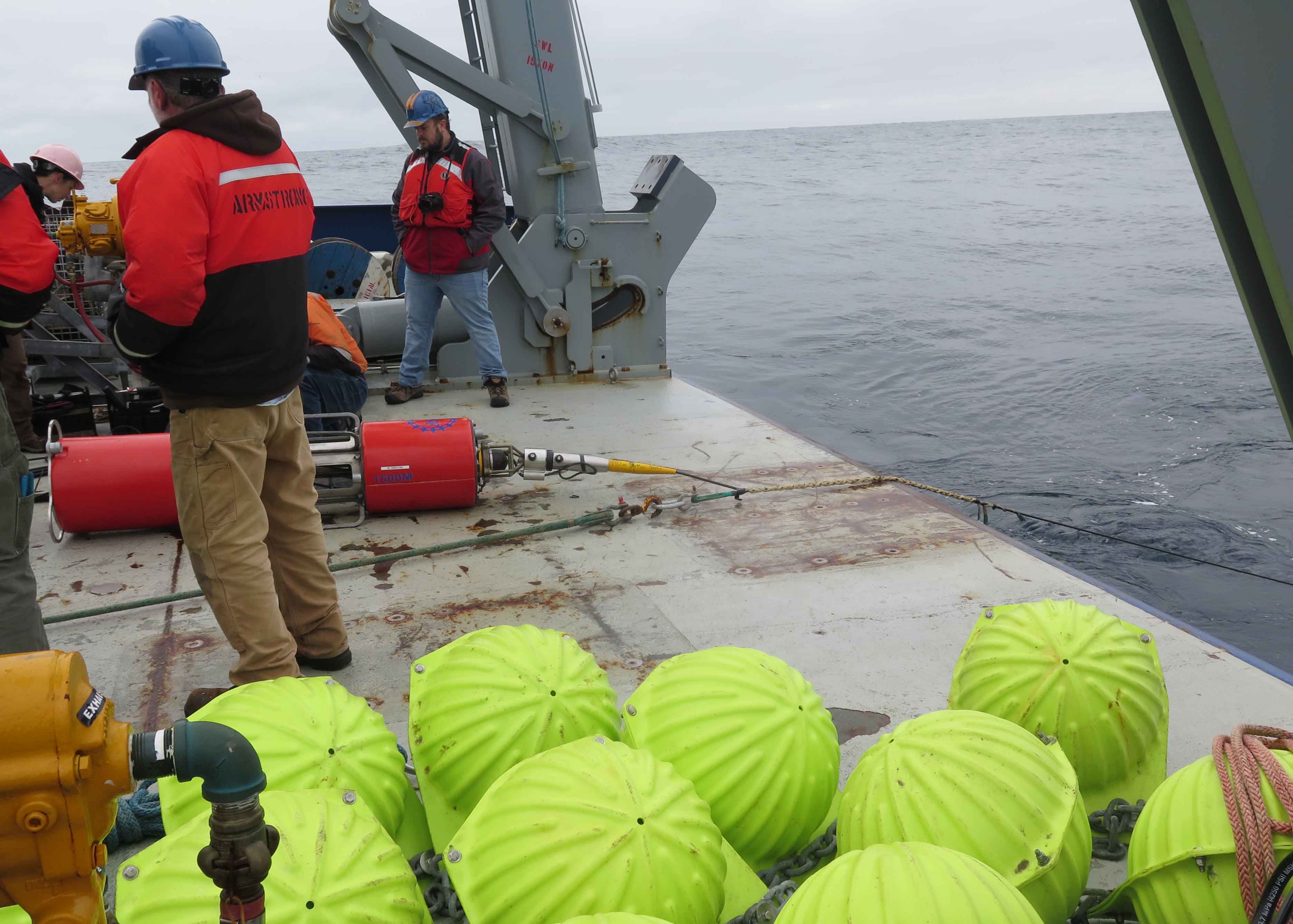
OSNAP proposals went in in 2011, and then again in 2012 until funding came through in 2013 from the National Science Foundation for the U.S. contribution and from the National Environmental Research Council for the UK. The observing system was put in place in the summer of 2014, and the first data recovery finished the summer of 2016.  A long road indeed, but it can hardly be any other way with a program of this scope and size.  And, as with any long journey, it is great to have companions along the way.  OSNAP came together because funding agencies in the US, UK, Germany, Canada, Netherlands, France and China invested in this science and because oceanographers from these countries worked together on this common goal.  I have been extraordinarily fortunate to work with such extraordinary oceanographers.  The wait has been worth it.  If you get a chance to read our Science article, I hope you agree.

For now, OSNAP remains in the water, while we analyze more results, apply for more funding and enjoy the long game in ocean science.

IPCC special report 1.5C warming

by Ric Williams

On 8 October a special report was released from the Intergovernmental Panel for Climate Change to highlight the impacts of global warming of 1.5oC above pre-industrial levels. The report is substantive and is led by 91 authors drawing upon inputs of over 2000 experts, nearly 500 reviewers and citing 6000 papers. The report is set in the context of the Paris Climate agreement in 2016, which aspires to keep global temperature rise to less than 2oC this century and to pursue efforts to limit the temperature rise even further to 1.5oC. What has been unclear is how long have we got until we reach this warmer climate and what are the likely consequences?

 The headline is alarming, the clock is ticking faster than we would like. There are a dozen years to keep below a global temperature rise of 1.5oC. We are on track to exceed this threshold by year 2030 given the present rate of carbon emissions. The message is simple: the more carbon we emit, the warmer the climate system becomes.  We need to reduce the amount of carbon we are emitting to the atmosphere.°°

The report assesses how a 1.5oC warmer world compares with a 2oC warmer world. Drawing upon climate model projections, there are robust differences in regional climate between a 1.5oC and 2oC warmer world: the mean temperature and extreme temperatures are higher for a 2oC world (high confidence) and there is heavier precipitation in some regions and drought in some other regions (medium confidence), and that there is an extra 10cm of sea level rise, affecting 10 million more people. The effects on the habitat are viewed as alarming with twice as much habitat loss for plants and insects for 2oC warming compared with 1.5oC warming. Warm-water corals are effectively wiped out with a 99% loss for 2oC warming, while 10% might survive with 1.5oC warming. Arctic sea-ice free summers are viewed as being once every 10 years with 2oC warming, rather than once every 100 years with 1.5oC warming.

There are real benefits to acting sooner to limit the increased warming of the climate system. What is needed is to reduce the amount of carbon emissions and the resulting amount of carbon dioxide in the atmosphere. Proposed solutions include reforestation, a shift to electric transport systems and development of carbon capture. The challenge is severe, we need to reduce global carbon emissions by 45% from year 2010 to 2030. We can only achieve this goal by keeping as much carbon as possible in the ground and not releasing further fossil fuels. Meeting this challenge will be demanding.  

MSM 74 – Blog Entry 5

Over the past week we made great progress in our journey of the sea, surveying an eddy off the west coast of Greenland with repeated ADCP and CTD surveys to investigate in detail the structure and content of these dynamic water features. We also deployed 2 more APEX floats in the centre of the eddy.

Johannes and Marie discussing the next Apex float deployment (credit: Sunke Schmidtko).

Float deployment in the eddy centre (credit: Arne Bendinger)

During the last few days while we finished the Labrador Sea part of our cruise and had our mid cruise celebration, I had the chance to sort out my thoughts and go through notes of conversations with more of the people on board. One thing I realized is that I never mentioned the amazing crew and captain of the Maria S. Merian. Without their patience, experience and watchful eye neither the mooring work, nor our CTD stations would have gone as smoothly as they did.

Sandra Schilling, 2nd Officer on the Maria S. Merian (Photo by Arne Bendinger)

Besides doing a great job manoeuvring the vessel around always changing CTD station plans, the watch officers are always happy to have us come up to the bridge to say enjoy the sunset or answer questions about the many instruments on board. The watch officer during my CTD shift is 2nd officer Sandra Schilling and she has been on board the Merian for just under a year. I think it is amazing to see women in these leading roles and I am glad I got to meet Sandra on this cruise. I asked Sandra if she misses being on land, since 8 month of the year she spends at sea, but Sandra told me she feels happiest at sea and at the end of her time on land she always feels excited to be back on board for the next voyage. Apparently the coolest thing about her job is to navigate in unchartered waters. Pun intended!

As the current week is coming to an end near the Cape Farewell, Greenland I am also ready to describe more of the great group of people I share this cruise with. I like interdisciplinary nature of our cruise. One of the scientists from Canada, fresh from finishing her honors thesis is Ciara Willis. Ciara described to me a lifelong passion for marine biology that started at age 4 inspired by conservation issues in Nova Scotia. Ciara recently finished a degree in Marine Biology and Statistics in which she took part in projects in both Canada and the US and is now on this cruise sampling nutrients and vitamins from the CTD casts to investigate microbial activity in the sea as part of a research project at her University.

Picture of Ciara Willis doing sampling in the Chemistry Lab

Ocean microbes are poorly understood and hard to cultivate in laboratories. Because microbes have such a fast lifecycle and are at the origin of the food chain for all other large aquatic species it is key to understand changes in their habitat to adapt better to climate change. One of the cool features of microbes such as phytoplankton is that they are a source of oxygen in the water through photosynthesis similar to plants. I think it is amazing to think that microbes in the ocean can behave like plants on the surface of the earth. Ciara’s hobbies at sea include bird watching and reading.

We are now closing in on the next and last part of our cruise which is to run CTD stations along Cape Farewell Greenland and then continue with the Eastern part of the OSNAP array, recovering moorings. The US research ship R/V Armstrong is also doing mooring recoveries in the vicinity and word has it we might even see each other in the coming days as a Rendevouz at Sea. Last December I already had the pleasure to visit this cool oceanographic research vessel and it will be exciting to see the ship in scientific action on the open seas!

Putting on the Grip – RV Armstrong

by Heather Furey

Friday, June 15th.  

Men’s World Cup on the ship’s satellite television?  Must be OSNAP time.

It is still gray and cool outside, approx. 4C and 40F.  But the rain is gone.  I saw the sun reflecting off the ocean surface in a break in the clouds once this morning, the ocean surface is dark silver.  Not the sun itself, just a derivative of the sun.  I’ll take it.  I have never been in the Irminger Sea this close to the southern tip of Greenland before; the ocean here seems more unpredictable than the Iceland Sea, where I have spent my last three OSNAP cruises.  Just an impression – it seems like you need to watch your back out here.  Water has been flat so far, though.  So far.

We deployed our first OSNAP mooring yesterday: M4, the farthest offshore mooring which just captures the outer edge of the DWBC off the east coast of Greenland.  This is the second mooring I have had the satisfaction of deploying, and it is a great pleasure seeing a mooring put in the water in a calm, controlled, effective manner.  One technique used by this mooring team is the use of a YaleGrip to transfer line tension or load off a partially payed out mooring line.  A person might need to do this to move a wire from one winch to another, or to take tension off a wire to attach and inline instrument where the wire termination is not favorable to secondary shackles – let’s say at the end of an electrical-mechanical (EM) cable.  I have never seen them used by any other mooring deployment group; it is possible I had not paid careful attention on previous cruises.

Photo of a YaleGrip on a workbench.

A YaleGrip in the rigging van.  The one pictured is the smallest we have out here, and is for the thinnest wire mooring cables.  The color coding at the ends indicated the strength of the grip.

Yale grips work like ‘finger traps’, the children’s toy made of woven strips of paper overlapped into a finger-sized tube. Put a finger in each side, and try to pull them out … stuck!   

Photo of a finger trap, a woven paper toy.

A finger trap toy.

The grips are each a set of four Kevlar flat ropes that are wrapped around a taught wire.  The grip begins with a loop (that can be later attached to a cleat or tie-off) secured in place with electrician’s tape.  The loop end is located at the inboard end of the mooring wire, and the grip reaches toward the overboard end of the wire.  Once the loop end is secured, the tension can then be slowly released from the original wire safely. 

Photo of a large instrument on the back deck of a ship connected to a wire with a YaleGrip woven around the wire.

A YaleGrip being used to transfer tension off the termination of an EM cable so that the inline instrument can be attached.

This may sound dry in text, but to see it done in action is not.  Once the loop of the YaleGrip is taped in place, two people send 1-2 meter lengths flying through the air in great arcs as the grip is put in place, wrapped around the mooring wire.  It is an interesting contrast to see the highest of technical moorings still at the mercy of the old craft.  As Jim Dunn puts it, “if you had a tug of war, the YaleGrip would win.”  I just like the on-the-fly old school nature of the load transfer; it has a certain beauty to it.

Putting on the grip.

Johannes Karstensen and Penny Holliday, on the MSMerian, are on the east side of Greenland now, and the plan (at least as of 15:00 on 15 June 2018) is for the Merian crew to recover OSNAP moorings M1, 2, and 3 tomorrow.  And we will follow in their wake on the 17th to begin deploying mooring in the same locations. 


56 N, 52 W

by Marilena Oltmanns

Blogpost auf Deutsch lesen

The temperature time series from 4000 m depth in the central Labrador Sea spans two years and is characterized by small and big waves and swirls. It is full of mysteries. As a postdoc from GEOMAR it‘s my second research expedition from St. John‘s to Reykjavik and my task on board is to assess the quality of the data to decide if the instruments can be re-deployed. This means that I am one of the first to look at the data after we recover the instruments from the water – in this case from 4000 m depth. Considering that we can hardly enter this region ourselves, we send measuring instruments there every two years to have them record what we cannot see.

Already a first glance at the data reveals that it‘s not as calm down there as one may think. Numerous oscillations in pressure, temperature and salinity reflect a colorful chaos of many different signals and only through careful analyses we may have the chance to decipher the causes underlying this rich variability. Where does the water originate from? When and where has it been at the surface? Which known or yet undetermined processes have changed it? And which time scales of variability are dominant? This deep, there is no clearly distinguishable seasonal cycle because the distance to the surface is too large. Instead, other mechanisms have left their imprint on the water near the sea floor, most of which cannot be identified by this initial glance. In fact, they may remain elusive even after rigorous analyses.

At any rate, this first look at the data tells me that the instrument has gone through an exciting two years – and that an engaging analysis is waiting for us. Bearing in mind that measurements can drift and have offsets, I always remember that no instrument is perfect and that it only shows us one small fraction of what is happening 4000 m below sea level. Much remains a mystery.


Glider missions in the Iceland Basin

by Xiaopei Lin

The eastern subpolar North Atlantic has a special role in the Atlantic Overturning Circulation (AMOC) and global climate change. The waters in this regions are subtropical-origin warm and salty water masses, which are carried by the North Atlantic Current. They either move further northward into the Nordic Seas or cyclonically circulate to the Irminger Sea and Labrador Sea and then transform into dense waters. Substantial heat is released along their pathways, which is pivotal to maintaining a relatively warm climate in Northern Europe.

As a component of the Overturning in the Subpolar North Atlantic Program (OSNAP), WHOI-OUC jointly deployed gliders (underwater autonomous vehicles) in the Iceland Basin. The Iceland Basin lies east of the Reykjanes Ridge and west of the Rockall Plateau. The battery in each glider can afford continuous scientific sampling up to 6 months. Therefore, a new mission needs be triggered every half year. This is very challenging because it is not easy to find suitable ships, especially in winter, to recover and deploy vehicles. We had to rent small boats in Iceland and launch gliders near the coast. The glider section is about 260 nautical miles (more than 425 km) south of Iceland. With an averaged horizontal flying speed of 0.2 m/s, the glider takes three to four weeks to navigate to the working site. If the glider needs to swim back to the coast, the vehicle had to stop scientific samplings one month before the battery run out. In other words, about one third (two months over 6 months) of energy will be spent on the non-scientific task!

Despite the various logistics we have to deal with, 6 glider missions have been successfully completed between June 2015 and December 2017. More than 3000 hydrographic profiles have been collected. Moving at approximately 0.2 m/s, gliders ‘fly’ through the ocean from surface to 1000 m. In each dive-climb cycle, they navigate along a sawtooth trajectory and measure temperature, conductivity (salinity), pressure and oxygen. The horizontal sample-spacing averages 3 km, but near the surface and 1000-m turnaround points distance ranges from hundreds of meters to 6 km. The surveyed section is along 58°N with endpoints at 24.5°W and 21°W, respectively. The section is about 200 km in length and a one-way transect is usually completed in 7–10 days.

Hydrographic properties in the Iceland Basin for mesoscale eddy and frontal circulation patterns near 58°N. The left panels show the ocean state on 3 -13 August, 2015, for absolute dynamic topography (a), glider potential temperature (c), and glider salinity (e). The corresponding ocean state on 14-20 December 2016 is displayed in the right panels (b, absolute dynamic topography; d, potential temperature; f, salinity). Glider transect is marked by black lines in a) and b). The isobaths in panel a) and b) are represented by gray lines. The gray contour lines from panel c) to f) display the relative potential density.

The In-situ observations indicate two circulation regimes in the Iceland Basin: a mesoscale eddy like pattern and northward flowing NAC pattern. When a mesoscale eddy is generated, the rotational currents associated with the eddy lead to both northward and southward flow in the Iceland basin. This is quite different from the broad northward flow associated with the NAC when there is no eddy. The transition between the two regimes coupled with the strong temperature front in the Iceland basin can modify the meridional temperature flux on the order of 0.3PW. The dramatic variability induced by alternating eddy and frontal patterns is also found in high-resolution (1/12°) HYCOM simulations. In addition, a separation of large scale and mesoscale processes in the model results suggests that eddies in the Iceland Basin make significant contributions to the variability of the total basinwide poleward heat flux on time scales from subseasonal to interannual.

Detailed examinations of satellite altimetry data suggest that the alternative occurrence of eddy and front are quite common in the Iceland Basin. Therefore, the observed two circulation regimes detected from glider data are generally representative of long-term conditions. The velocity change associated with the eddy and front scenarios contribute to high Eddy Kinetic Energy (EKE). The surface EKE from altimetry data suggest that enhanced EKE is located in the eastern part of the subpolar region, especially in the Iceland Basin and Rockall Trough, coincident with the branches of the NAC. Similar EKE map is also reproduced by the eddy-resolving (1/12°) HYCOM simulations. In addition, the model results reveal that EKE along the OSNAP East line has nice correspondence with the meridional heat transport variability, with the highest values located in the Iceland Basin. As a result, the eddy and front structures captured by the gliders are the dominant processes to generate the temperature transport variability in the Iceland Basin.

a) Mean surface Eddy Kinetic Energy (EKE) from 1993 to 2015 from the satellite data. Unit: m^2/s^2. Magenta dash line represents the OSNAP East. Black diamonds denote the end points for the glider transect. The isobaths are illustrated by white contour lines.
b) Standard deviation of the meridional heat transport at each longitude in numerical simulations (red). The mean surface geostrophic EKE from altimeter observations (1992-2015) and numerical model (1992-2014) are displayed in blue and black, respectively. The vertical black dashed lines mark the endpoints of the glider transect, where the meridional heat transport has largest variability.

The results from the glider observations provide a fresh perspective on the dynamics responsible for the poleward heat transport in the subpolar North Atlantic Ocean, revealing that the alternating eddy and front patterns contributes significantly to the total poleward heat transport variability on time scales from subseasonal to interannual. This is different from our understanding about the mechanisms for oceanic heat transport variability, where large-scale circulation changes are believed to be the main driver. Our results emphasize the importance of resolving mesoscale processes in observations and numerical simulations to realistically capture their roles in modulating heat transport variability in the northern North Atlantic. High-resolution observational arrays capable of capturing both large scale and mesoscale variability, such as the OSNAP observing system (which includes moorings, gliders, Argo floats and satellite altimetry), are needed to measure the basinwide ocean MHT in the subpolar North Atlantic.

Results were recently published in Nature Communications:

Zhao, J., A. Bower, J. Yang, and X. Lin, 2018. Meridional heat transport variability induced by mesoscale processes in the subpolar North Atlantic. Nature Communications, 9, 1124, doi: 10.1038/s41467-018-03134-x

https://www.nature.com/articles/s41467-018-03134-x


All of science in one month

by Femke de Jong

Science has many aspects. The collection of data on the process of region you are studying; the actual digging through the data to find out what is going on (which is what most people seem to associate with science); writing down the results so they are documented and others can learn what you learned;  discussing the results with colleagues in your fields and hearing about new methods and results; and the training of new scientists. Sometime all of these happen within a very short time frame.

After finishing a proposal and a paper draft at the end of January, February started with a short research cruise. This may not have been an OSNAP cruise, but all hydrographic cruises share very similar aspects. The run-up to the cruise is a lot about getting the logistics arranged and preparing a cruise plan. Does everyone have

The RV Pelagia, our home for the duration of this cruise.

the right paperwork to go on board? How are we going to divide the tasks on board? How many measurements stations will be able to do and where? And most importantly… will all the instruments work and the data be good? Once on board things start to fall into place. Those who are back in their familiar environment show the ropes to the newcomers. Instruments are prepared and plans discussed with the ship’s crew. During the cruise, while data collection progresses, we process the initial results and get an idea of whether our science goals will be fulfilled. Once land is in sight on the other end of the cruise everyone is tired and ready to go home.

Unless, due to some haphazard planning, you need to proceed directly to a scientific conference. While cruise departure and arrival day are never fixed until you actually departed or arrived, dates of meetings with several thousand participants tend to be quite fixed. The Ocean Sciences Meeting is a biannual meeting with all fields of oceanography. About 5000 people met in Portland, OR, this week to discuss their work. This happens in “sessions”, submeetings organized by topic, of which there were nearly 500. The new OSNAP results were presented in

Closing remarks at the OSM18.

the AMOC (Atlantic Meridional Overturning Circulation) session. Several of us had oral talks. Susan Lozier presented the (near) final numbers of the overturning over the whole OSNAP line. Penny Holliday shows us the circulation estimates from the OSNAP hydrographic sections in 2014 and 2016. Bill Johns detailed the Iceland Scotland Overflow Water flow along the east flank of the Reykjanes Ridge. I presented our investigation of variability west of the Reykjanes Ridge. Feili Li compared Labrador Sea Water formation with Labrador Sea overturning. More OSNAP talks were held in other sessions (see OSM blog post). Since there are too many of us to all get talks (even if they only last 15 min) some are requested to present posters. Poster sessions are held during the last two hours of the day. Presenters stand next to their posters and the rest of use walk around and either browse poster titles to find something that interests us or seek out poster titles we identified beforehand in the program. Often the most interesting discussions are held at posters we unintendedly come across and these are great chances to meet new people. Between the talks and posters we catch up with old friends or meeting with co-authors on papers or potential new collaborators.

Now that I’ve returned from the Ocean Sciences Meeting I’m starting a new chapter. My first PhD student, Roos Bol, has started her position at NIOZ this week. She recently finished her MSc thesis at the NOC in Southampton and I’m very excited to be working with her. She’ll be investigating our OSNAP data from the Irminger Current array and will be coming along on this summer’s OSNAP cruise. Over the next four year I’ll expect to be teaching her all about data collection, data processing, writing down results and giving presentations at conferences.

Ocean array alters view of Atlantic ‘conveyor belt’ in Science News

Katherine Kornei captures an overview of the Atlantic Meridional Overturning Circulation, and OSNAP’s role in observing overturning in the North Atlantic. The summary “Ocean array alters view of Atlantic ‘conveyor belt’” can be found here.

Nature – News

Earlier this week many of the researchers and scientists involved in OSNAP presented their work, based on the first two years of continuous monitoring in the North Atlantic, at the Ocean Sciences Meeting in Portland, OR. While there are still a lot of implications and details forthcoming, Nature – News reported on these findings in a short summary linked below.

 Read full Nature article

LabSea2020 – A new international cooperative research program in the Labrador Sea.

by Doug Wallace, Dalhousie University and Brad deYoung, Memorial University

The Labrador Sea, off the east coast of Canada (see figure), is one of the few places where the deep ocean exchanges gases such as oxygen and carbon dioxide (CO2) directly with the atmosphere. Localized deep convection releases large amounts of heat to the atmosphere and the resulting Labrador Sea Water contributes to the global ocean thermohaline circulation that redistributes heat from low latitudes to the poles. Transport out of the Labrador Sea carries oxygen and anthropogenic CO2 into the North Atlantic interior, oxygenating subsurface layers and slowing the accumulation of CO2 in the atmosphere, but exacerbating ocean acidification along Canada’s sensitive eastern continental margin. The combined action of convection and horizontal circulation redistributes nutrients and contaminants (e.g. from future deepwater oil production along the deep Labrador slope) potentially affecting ocean productivity and marine ecosystem health.

Read More: LabSea2020 PDF